
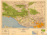
~ Los Angeles CA topo map, 1:250000 scale, 1 X 2 Degree, Historical, 1949, updated 1949
Los Angeles, California, USGS topographic map dated 1949.
Includes geographic coordinates (latitude and longitude). This topographic map is suitable for hiking, camping, and exploring, or framing it as a wall map.
Printed on-demand using high resolution imagery, on heavy weight and acid free paper, or alternatively on a variety of synthetic materials.
Topos available on paper, Waterproof, Poly, or Tyvek. Usually shipping rolled, unless combined with other folded maps in one order.
- Product Number: USGS-5506579
- Free digital map download (high-resolution, GeoPDF): Los Angeles, California (file size: 15 MB)
- Map Size: please refer to the dimensions of the GeoPDF map above
- Weight (paper map): ca. 55 grams
- Map Type: POD USGS Topographic Map
- Map Series: HTMC
- Map Verison: Historical
- Cell ID: 68882
- Scan ID: 707453
- Imprint Year: 1949
- Woodland Tint: Yes
- Aerial Photo Year: 1944
- Datum: NAD27
- Map Projection: Transverse Mercator
- Shaded Relief map: Yes
- Map published by United States Army Corps of Engineers
- Map published by United States Army
- Map Language: English
- Scanner Resolution: 508 dpi
- Map Cell Name: Los Angeles
- Grid size: 1 X 2 Degree
- Date on map: 1949
- Map Scale: 1:250000
- Geographical region: California, United States
Neighboring Maps:
All neighboring USGS topo maps are available for sale online at a variety of scales.
Spatial coverage:
Topo map Los Angeles, California, covers the geographical area associated the following places:
- Singing Springs - La Quinta - Oak View - Springville - El Sereno - Cabrillo Village - Naples - Sun Valley - Miscanaka (historical) - La Paco - Fairmont - Runnymede Poultry Colony (historical) - Mahou Riviera - Weldons - Corriganville - Sandberg - Oak Knoll - Kester - Little Tokyo - Serena - Glendale Junction - Nyland - Nevin - Stoneman - Rincon - Sulphur Springs - Chatsworth Lake Manor - Clayton (historical) - Wyvernwood - Chatsworth - Jefferson - Lebec - Topanga Oaks - Lake View Terrace - Chrisman - Avenue E Trailer Park - Studio City - Lagol - Three Points - Magnolia Park - Tujunga - Belvedere - Edendale (historical) - Deer Lake Highlands - Valencia - Acton - Stallion Meadow Mobile Home Park - Picfair Village - Sandyland Cove - North El Monte - Montebello - Arbolada - Epworth - East San Gabriel - Wadstrom - Matilija - Hayes - Franciscan Village - Golden Oaks Mobile Home Park - Montalvo - Seminole Springs Trailer Park - Wilmar - West Hollywood - Winnetka - Country Club Park - Ventura - Eastmont - Holland Summit (historical) - San Gabriel - Butte Street Junction - Agoura - Somis (historical) - Virginia Colony - Pleasant Valley Mobile Home Park - Bandini - Cienega - Paris - West Arcadia - Oban - Aurant - Matilija Springs - Ventucopa - Brooklyn Heights - Toro Canyon - Santa Clarita - Temple City - Point Dume Mobile Home Park - Ojai Valley Estates Mobile Home Park - Grapevine - Buckhorn - Rancho Vista - Aliso Village - Malibu - Wildwood - Reseda - Beverly Hills - Lamanda Park - Mint Canyon - El Dorada Mobile Estates - Northridge
- Map Area ID: AREA3534-120-118
- Northwest corner Lat/Long code: USGSNW35-120
- Northeast corner Lat/Long code: USGSNE35-118
- Southwest corner Lat/Long code: USGSSW34-120
- Southeast corner Lat/Long code: USGSSE34-118
- Northern map edge Latitude: 35
- Southern map edge Latitude: 34
- Western map edge Longitude: -120
- Eastern map edge Longitude: -118


