
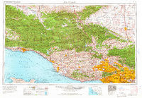
~ Los Angeles CA topo map, 1:250000 scale, 1 X 2 Degree, Historical, 1966
Los Angeles, California, USGS topographic map dated 1966.
Includes geographic coordinates (latitude and longitude). This topographic map is suitable for hiking, camping, and exploring, or framing it as a wall map.
Printed on-demand using high resolution imagery, on heavy weight and acid free paper, or alternatively on a variety of synthetic materials.
Topos available on paper, Waterproof, Poly, or Tyvek. Usually shipping rolled, unless combined with other folded maps in one order.
- Product Number: USGS-5506571
- Free digital map download (high-resolution, GeoPDF): Los Angeles, California (file size: 23 MB)
- Map Size: please refer to the dimensions of the GeoPDF map above
- Weight (paper map): ca. 55 grams
- Map Type: POD USGS Topographic Map
- Map Series: HTMC
- Map Verison: Historical
- Cell ID: 68882
- Scan ID: 299817
- Woodland Tint: Yes
- Field Check Year: 1959
- Datum: Unstated
- Map Projection: Transverse Mercator
- Map published by United States Army Corps of Engineers
- Map published by United States Army
- Map Language: English
- Scanner Resolution: 600 dpi
- Map Cell Name: Los Angeles
- Grid size: 1 X 2 Degree
- Date on map: 1966
- Map Scale: 1:250000
- Geographical region: California, United States
Neighboring Maps:
All neighboring USGS topo maps are available for sale online at a variety of scales.
Spatial coverage:
Topo map Los Angeles, California, covers the geographical area associated the following places:
- Sandyland - Castaic Junction - Mussel Shoals - Whittier Junction - Hewitt - Three Points - Coromar - Carthay Square - Chapman - Redondo Junction - Sylmar - North El Monte - Holland Summit (historical) - Oberg (historical) - Camulos - Point Dume Mobile Home Park - Desert View Highlands - Brents Junction - Santa Maria - El Monte - Leesdale - Rancho Vista - El Sereno Estates Mobile Home Park - Hollywood by the Sea - West Saticoy - New Cuyama - Castellammare - Wellington Heights - Malibu Vista - Irma - Owl Mobile Manor - Topanga Oaks - Burbank Junction - Soto Street Junction - Moorpark - Cypress Park - Rosemead - Magnolia Park - Lake Hughes - Sulphur Springs - Fairview - East Los Angeles - Arbolada - Los Angeles - San Marino - Valencia - Rancho Santa Paul Mobile Home Park - Sierra Villa Mobile Home Park - Alpine - Century City - Linda Vista - Saticoy - San Roque Mobile Home - Larchmont Village - Meiners Oaks - Santa Susana - Santa Paula - Pearland - Sunrise - Hidden Springs - Shepards - Brentwood - Baldwin Hills - Grapevine - Roosevelt - Newbury Park - Topanga Beach - Conejo Valley Trailer Park - Seminole Springs Trailer Park - Mayflower Village - Alpine (historical) - Butte Street Junction - Mar Vista Houses - Oak View - Home Junction - Riviera - Encino - Mishopshnow (historical) - Culver City - Oban - Lamanda Park - Boston Heights - Eastmont - Northridge - Lamplighter Mobile Home Park - Brooklyn Heights - Ansel - Spanish Hills - Cavin - Bartolo (historical) - Summerland - Garvanza - Olga - La Patera - Malibu Junction - Burbank - Studio City - Hobart - Port Hueneme - Stallion Meadow Mobile Home Park
- Map Area ID: AREA3534-120-118
- Northwest corner Lat/Long code: USGSNW35-120
- Northeast corner Lat/Long code: USGSNE35-118
- Southwest corner Lat/Long code: USGSSW34-120
- Southeast corner Lat/Long code: USGSSE34-118
- Northern map edge Latitude: 35
- Southern map edge Latitude: 34
- Western map edge Longitude: -120
- Eastern map edge Longitude: -118


