
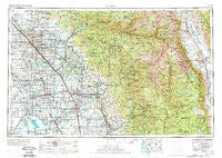
~ Fresno CA topo map, 1:250000 scale, 1 X 2 Degree, Historical, 1962, updated 1974
Fresno, California, USGS topographic map dated 1962.
Includes geographic coordinates (latitude and longitude). This topographic map is suitable for hiking, camping, and exploring, or framing it as a wall map.
Printed on-demand using high resolution imagery, on heavy weight and acid free paper, or alternatively on a variety of synthetic materials.
Topos available on paper, Waterproof, Poly, or Tyvek. Usually shipping rolled, unless combined with other folded maps in one order.
- Product Number: USGS-5506559
- Free digital map download (high-resolution, GeoPDF): Fresno, California (file size: 25 MB)
- Map Size: please refer to the dimensions of the GeoPDF map above
- Weight (paper map): ca. 55 grams
- Map Type: POD USGS Topographic Map
- Map Series: HTMC
- Map Verison: Historical
- Cell ID: 68792
- Scan ID: 299775
- Imprint Year: 1974
- Woodland Tint: Yes
- Visual Version Number: 2
- Aerial Photo Year: 1971
- Edit Year: 1971
- Field Check Year: 1962
- Datum: Unstated
- Map Projection: Transverse Mercator
- Map published by United States Geological Survey
- Map published by: Military, Other
- Map Language: English
- Scanner Resolution: 600 dpi
- Map Cell Name: Fresno
- Grid size: 1 X 2 Degree
- Date on map: 1962
- Map Scale: 1:250000
- Geographical region: California, United States
Neighboring Maps:
All neighboring USGS topo maps are available for sale online at a variety of scales.
Spatial coverage:
Topo map Fresno, California, covers the geographical area associated the following places:
- Cotton Center - Sequoia - Gordon - Roche - Cecile - Pinehurst - Ponca - Lindcove - Plainview - Gepford - Mineral King - Kimble (historical) - Spinks Corner - Jones Corner - Olancha - Sentinel (historical) - Sierra Vista Mobile Estates - Twin Buttes - Hoffman Point - North Dinuba - Primero (historical) - Shell - Stony Creek Village - Prewit (historical) - Orange Cove - Kettleman City - Riverview (historical) - Cimarron - Poplar - Goshen - Hardwick - Fig Garden - Pleasant Grove (historical) - Seville - Sparkville (historical) - Sanger - Cedar Grove - Red Fir - Musk (historical) - Paige - Glorietta - Quail - Figarden - Hammond - Piedra - Bonadelle Ranchos Nine - Yokohl - Gregg - Blanco - Hub - Fowler - Nanceville - Hartland - Smyrna (historical) - Biola Junction - Grant Grove Village - Bel Air Mobile Home Park - Goodmill - Wyeth - Corcoran - Octol - Strathmore - Antes - Hanford - Minkler - Dickerson (historical) - Collins (historical) - Citro - Loma - Portex (historical) - Goodale - Lort - Exeter - Hamblin - Caruthers - Ivesta - Saint Johns - Camden - Lankershim (historical) - Riverdale - Harmony - Enson - Armona - Millwood (historical) - Gillete - Lethent (historical) - Millham City (historical) - Sierra Heights - Remnoy - Hume Station - Oak Grove - Monmouth - Sultana - Monson - Highway City - Merryman - Orosi - Hume - Rolling Hills - Visalia
- Map Area ID: AREA3736-120-118
- Northwest corner Lat/Long code: USGSNW37-120
- Northeast corner Lat/Long code: USGSNE37-118
- Southwest corner Lat/Long code: USGSSW36-120
- Southeast corner Lat/Long code: USGSSE36-118
- Northern map edge Latitude: 37
- Southern map edge Latitude: 36
- Western map edge Longitude: -120
- Eastern map edge Longitude: -118


