
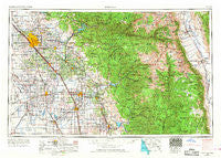
~ Fresno CA topo map, 1:250000 scale, 1 X 2 Degree, Historical, 1962, updated 1968
Fresno, California, USGS topographic map dated 1962.
Includes geographic coordinates (latitude and longitude). This topographic map is suitable for hiking, camping, and exploring, or framing it as a wall map.
Printed on-demand using high resolution imagery, on heavy weight and acid free paper, or alternatively on a variety of synthetic materials.
Topos available on paper, Waterproof, Poly, or Tyvek. Usually shipping rolled, unless combined with other folded maps in one order.
- Product Number: USGS-5506557
- Free digital map download (high-resolution, GeoPDF): Fresno, California (file size: 23 MB)
- Map Size: please refer to the dimensions of the GeoPDF map above
- Weight (paper map): ca. 55 grams
- Map Type: POD USGS Topographic Map
- Map Series: HTMC
- Map Verison: Historical
- Cell ID: 68792
- Scan ID: 299774
- Imprint Year: 1968
- Woodland Tint: Yes
- Edit Year: 1967
- Datum: Unstated
- Map Projection: Transverse Mercator
- Map published by United States Geological Survey
- Map published by: Military, Other
- Map Language: English
- Scanner Resolution: 600 dpi
- Map Cell Name: Fresno
- Grid size: 1 X 2 Degree
- Date on map: 1962
- Map Scale: 1:250000
- Geographical region: California, United States
Neighboring Maps:
All neighboring USGS topo maps are available for sale online at a variety of scales.
Spatial coverage:
Topo map Fresno, California, covers the geographical area associated the following places:
- Odessa (historical) - River Road Estates - Tulare - Millham City (historical) - Sparkville (historical) - Fresno Beach (historical) - Loma - Sierra Heights - Kearsarge - Ellis Place - Soda Springs - West Park - Barstow - Olancha - Blanco - Goshen - Big Bunch - Taurusa - Riverbend - Biola Junction - Pinewood - Gepford - Rayo - Red Fir - Hawkins (historical) - Hanford Del Arroyo Estates - Hartland - Matchin - Kanawyers - Riverview (historical) - Prewit (historical) - Magnolia - Sandspur (historical) - Kingston (historical) - Silver City - Shirley - Hanford - Cecile - Conejo - Lois - Tara Mobile Estates - Millwood (historical) - Chinowths Corner - Burrel - Burling (historical) - Guernsey - Cedarbrook - Fort Roosevelt - Wyeth - Springville - Monmouth - Cincotta - Raisin City - Kingsburg - Independence - Worth - Yettem - Dinuba - Lumer - Ivory - Cartago - Stony Creek Village - East Porterville - Hub - Clovis - Jones Corner - Sanger - Higby - List - Mattei - Cedar Slope - Lillis (historical) - Lankershim (historical) - Milo - Melvin - Tokay - Camp Nelson - Corcoran - Pleasant Grove (historical) - Parlier - Bronge (historical) - Camden - South Corcoran - Kings Mobile Home Estates - Nanceville - Trimmer - Vanguard - Tipton - Banner (historical) - Traver - Auckland - Wheatons - Toolville - North Dinuba - Westhaven - Vance - Piedra - Kaweah - Burness - Rector
- Map Area ID: AREA3736-120-118
- Northwest corner Lat/Long code: USGSNW37-120
- Northeast corner Lat/Long code: USGSNE37-118
- Southwest corner Lat/Long code: USGSSW36-120
- Southeast corner Lat/Long code: USGSSE36-118
- Northern map edge Latitude: 37
- Southern map edge Latitude: 36
- Western map edge Longitude: -120
- Eastern map edge Longitude: -118


