
~ Fresno CA topo map, 1:250000 scale, 1 X 2 Degree, Historical, 1960, updated 1960
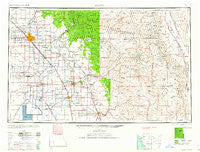
Fresno, California, USGS topographic map dated 1960.
Includes geographic coordinates (latitude and longitude). This topographic map is suitable for hiking, camping, and exploring, or framing it as a wall map.
Printed on-demand using high resolution imagery, on heavy weight and acid free paper, or alternatively on a variety of synthetic materials.
Topos available on paper, Waterproof, Poly, or Tyvek. Usually shipping rolled, unless combined with other folded maps in one order.
- Product Number: USGS-5506553
- Free digital map download (high-resolution, GeoPDF): Fresno, California (file size: 16 MB)
- Map Size: please refer to the dimensions of the GeoPDF map above
- Weight (paper map): ca. 55 grams
- Map Type: POD USGS Topographic Map
- Map Series: HTMC
- Map Verison: Historical
- Cell ID: 68792
- Scan ID: 299772
- Imprint Year: 1960
- Woodland Tint: Yes
- Visual Version Number: 2
- Aerial Photo Year: 1944
- Datum: Unstated
- Map Projection: Transverse Mercator
- Map published by United States Geological Survey
- Map published by United States Army Corps of Engineers
- Map published by United States Army
- Map Language: English
- Scanner Resolution: 600 dpi
- Map Cell Name: Fresno
- Grid size: 1 X 2 Degree
- Date on map: 1960
- Map Scale: 1:250000
- Geographical region: California, United States
Neighboring Maps:
All neighboring USGS topo maps are available for sale online at a variety of scales.
Spatial coverage:
Topo map Fresno, California, covers the geographical area associated the following places:
- Higby - Rocky Hill - Hume Station - Springville - Sumner Hill - Tipton - Schilling - Ellis Place - Rossi - Clotho - Pitco - Collins (historical) - Lanare - Lone Pine - Remnoy - Hammond - Milo - Balch Camp - Butler (historical) - Three Rivers - Easton - River Road Estates - Blanco - Tonyville - Muscatel - Lemoore - Merryman - Sparkville (historical) - Wildflower - Millwood (historical) - Shipp (historical) - Bronge (historical) - Camden - Highway City - Auckland - Stout - Vanris (historical) - Kimble (historical) - Fane - Navelencia - Tara Mobile Estates - Alta Vista (historical) - Sanger - Octol - Shirley - Tarpey Village - Goshen - Pleasant Grove (historical) - Etheda Springs - Plainview - Elba - Toolville - Floyd - Poplar - Figarden - Bonadelle Ranchos - Banner (historical) - Hammond - Irrigosa - Kings Mobile Home Estates - Monson - Zante - Mitchell Corner - Elk - Crabtree - Badger - Manzanar - Sawmill Flat - Rolling Hills - Bel Air Mobile Home Park - Quail - Pratton - Lacjac - Sierra Heights - Orosi - Red Fir - Taurusa - Saint Johns - North Dinuba - Tiffin (historical) - Enson - Ponca - Bean (historical) - Hume - Orange Cove - Strathmore - East Porterville - Grant Grove Village - Abilene - Rayo - Helm Corner - Hartland - Clint - Hillmaid - Blackrock - Mattei - Bowles - Calgro - Ponderosa - South Corcoran
- Map Area ID: AREA3736-120-118
- Northwest corner Lat/Long code: USGSNW37-120
- Northeast corner Lat/Long code: USGSNE37-118
- Southwest corner Lat/Long code: USGSSW36-120
- Southeast corner Lat/Long code: USGSSE36-118
- Northern map edge Latitude: 37
- Southern map edge Latitude: 36
- Western map edge Longitude: -120
- Eastern map edge Longitude: -118


