
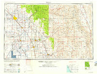
~ Fresno CA topo map, 1:250000 scale, 1 X 2 Degree, Historical, 1958, updated 1958
Fresno, California, USGS topographic map dated 1958.
Includes geographic coordinates (latitude and longitude). This topographic map is suitable for hiking, camping, and exploring, or framing it as a wall map.
Printed on-demand using high resolution imagery, on heavy weight and acid free paper, or alternatively on a variety of synthetic materials.
Topos available on paper, Waterproof, Poly, or Tyvek. Usually shipping rolled, unless combined with other folded maps in one order.
- Product Number: USGS-5506549
- Free digital map download (high-resolution, GeoPDF): Fresno, California (file size: 17 MB)
- Map Size: please refer to the dimensions of the GeoPDF map above
- Weight (paper map): ca. 55 grams
- Map Type: POD USGS Topographic Map
- Map Series: HTMC
- Map Verison: Historical
- Cell ID: 68792
- Scan ID: 299770
- Imprint Year: 1958
- Woodland Tint: Yes
- Aerial Photo Year: 1944
- Datum: Unstated
- Map Projection: Transverse Mercator
- Map published by United States Army Corps of Engineers
- Map published by United States Army
- Map Language: English
- Scanner Resolution: 600 dpi
- Map Cell Name: Fresno
- Grid size: 1 X 2 Degree
- Date on map: 1958
- Map Scale: 1:250000
- Geographical region: California, United States
Neighboring Maps:
All neighboring USGS topo maps are available for sale online at a variety of scales.
Spatial coverage:
Topo map Fresno, California, covers the geographical area associated the following places:
- Cairns Corner - Kingston (historical) - Alabama Hills - Bonadelle Ranchos Nine - Robinson (historical) - Wildflower - Poplar - Woodlake Junction - Zante - San Joaquin River Estates - Mitchell Corner - Selma - Pratton - Grey Rocks (historical) - Hardwick - Bowles - Calwa - Biola Junction - Lacjac - Lois - Rodgers Crossing - Raisin City - Granz (historical) - Merryman - Silver City - Lindcove - Grant Grove Village - Burling (historical) - Kings Mobile Home Estates - Sultana - Peral - Bender (historical) - Worthing (historical) - Waukena - Tipton - Shirley - Chinowths Corner - Gepford - Cedarbrook - Gillete - Abilene - Elm View - Tokay - Fort Roosevelt - Bonadelle Ranchos - Lumer - Hammond - Owenyo - Remnoy - Locans - Pleasant Grove (historical) - Schilling - Clotho - Miley - Oleander - Figarden - Harmony - Raco - Riverdale - Oakhurst (historical) - Madera Ranchos - Mineral King - Plainview - Elderwood - Sanger - Letcher (historical) - River Road Estates - Venida - Farmersville - Seville - Wolf - Alta Vista (historical) - Lemoore - Hanford Del Arroyo Estates - Lankershim (historical) - Cotton Center - Burness - Enson - Cedar Slope - Sequoia - Riverbend - Etheda Springs - Globe - Vincent - Avocado - Sides (historical) - Bonadelle Ranchos Five - Hoffman Point - Uva - Tara Mobile Estates - Hammond - Corcoran - Manzanar - Ambler - Seven Pines - Reynolds (historical) - Hartland - Whitley Manor Mobile Home Park - Burrel - Caruthers
- Map Area ID: AREA3736-120-118
- Northwest corner Lat/Long code: USGSNW37-120
- Northeast corner Lat/Long code: USGSNE37-118
- Southwest corner Lat/Long code: USGSSW36-120
- Southeast corner Lat/Long code: USGSSE36-118
- Northern map edge Latitude: 37
- Southern map edge Latitude: 36
- Western map edge Longitude: -120
- Eastern map edge Longitude: -118


