
~ Death Valley CA topo map, 1:250000 scale, 1 X 2 Degree, Historical, 1948, updated 1948
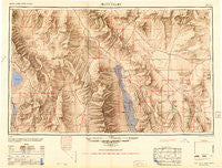
Death Valley, California, USGS topographic map dated 1948.
Includes geographic coordinates (latitude and longitude). This topographic map is suitable for hiking, camping, and exploring, or framing it as a wall map.
Printed on-demand using high resolution imagery, on heavy weight and acid free paper, or alternatively on a variety of synthetic materials.
Topos available on paper, Waterproof, Poly, or Tyvek. Usually shipping rolled, unless combined with other folded maps in one order.
- Product Number: USGS-5506519
- Free digital map download (high-resolution, GeoPDF): Death Valley, California (file size: 14 MB)
- Map Size: please refer to the dimensions of the GeoPDF map above
- Weight (paper map): ca. 55 grams
- Map Type: POD USGS Topographic Map
- Map Series: HTMC
- Map Verison: Historical
- Cell ID: 74981
- Scan ID: 299750
- Imprint Year: 1948
- Aerial Photo Year: 1945
- Datum: NAD27
- Map Projection: Transverse Mercator
- Shaded Relief map: Yes
- Map published by United States Army Corps of Engineers
- Map published by United States Army
- Map published by United States Department of War
- Map Language: English
- Scanner Resolution: 600 dpi
- Map Cell Name: Death Valley
- Grid size: 1 X 2 Degree
- Date on map: 1948
- Map Scale: 1:250000
- Geographical region: California, United States
Neighboring Maps:
All neighboring USGS topo maps are available for sale online at a variety of scales.
Spatial coverage:
Topo map Death Valley, California, covers the geographical area associated the following places:
- Lookout City (historical) - Darwin - Junction Ranch - Evelyn - Grant - Roses Well (historical) - Haiwee - Bullfrog (historical) - Gold Bar (historical) - Crystal - Dolomite - Chloride City (historical) - Rhyolite - Millspaugh - Lane Mill (historical) - Panamint - Ashton - Bowlerville (historical) - Camp Desert Rock - Ashmeadow (historical) - Beveridge - Teakettle Junction - Badwater - Park Village - Leeland (historical) - Swansea - Skidoo (historical) - Amargosa Valley - Sykes - Beatty Junction - Johnnie - Ryan - Leadfield - Dunmovin - Greenwater (historical) - Hot Springs - Talus - Beatty - Schwaub (historical) - Millspaugh (historical) - Ballarat - Reilly (historical) - Wahmonie (historical) - Keeler - Alico - Labbe Camp - Amargosa (historical) - Harrisburg - Coso Junction - Death Valley Junction - Panamint Springs - Furnace Creek - Lila C (historical) - Indian Village - Carrara (historical) - Scranton - Furnace (historical) - Fluorine (historical) - Original (historical) - Mock - Gold Center
- Map Area ID: AREA3736-118-116
- Northwest corner Lat/Long code: USGSNW37-118
- Northeast corner Lat/Long code: USGSNE37-116
- Southwest corner Lat/Long code: USGSSW36-118
- Southeast corner Lat/Long code: USGSSE36-116
- Northern map edge Latitude: 37
- Southern map edge Latitude: 36
- Western map edge Longitude: -118
- Eastern map edge Longitude: -116


