
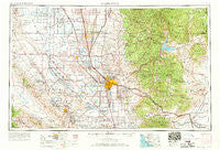
~ Bakersfield CA topo map, 1:250000 scale, 1 X 2 Degree, Historical, 1962, updated 1969
Bakersfield, California, USGS topographic map dated 1962.
Includes geographic coordinates (latitude and longitude). This topographic map is suitable for hiking, camping, and exploring, or framing it as a wall map.
Printed on-demand using high resolution imagery, on heavy weight and acid free paper, or alternatively on a variety of synthetic materials.
Topos available on paper, Waterproof, Poly, or Tyvek. Usually shipping rolled, unless combined with other folded maps in one order.
- Product Number: USGS-5506499
- Free digital map download (high-resolution, GeoPDF): Bakersfield, California (file size: 20 MB)
- Map Size: please refer to the dimensions of the GeoPDF map above
- Weight (paper map): ca. 55 grams
- Map Type: POD USGS Topographic Map
- Map Series: HTMC
- Map Verison: Historical
- Cell ID: 68661
- Scan ID: 299732
- Imprint Year: 1969
- Woodland Tint: Yes
- Edit Year: 1968
- Field Check Year: 1962
- Datum: Unstated
- Map Projection: Transverse Mercator
- Map published by United States Army Corps of Engineers
- Map published by United States Army
- Map Language: English
- Scanner Resolution: 600 dpi
- Map Cell Name: Bakersfield
- Grid size: 1 X 2 Degree
- Date on map: 1962
- Map Scale: 1:250000
- Geographical region: California, United States
Neighboring Maps:
All neighboring USGS topo maps are available for sale online at a variety of scales.
Spatial coverage:
Topo map Bakersfield, California, covers the geographical area associated the following places:
- Allensworth - Saco - Lamont - Lokern - Gold Town (historical) - Stallion Springs - Radnor - Canebrake - Delano - Mojave - Crome - Jasmin - Vinland - Idlewild - North Shafter - Kettleman Station - Jastro - Sugarloaf Mountain Park - Shafter - Cameron - Asphalto (historical) - Hights Corner - Riverkern - Lackey Place - Sage (historical) - Oil Junction - Squirrel Mountain Valley - California Hot Springs - Sugarloaf Village - Lake Isabella - Roads End - South Taft - Glennville - Lerdo - Spear Creek Summer Home Tract - Hazelton - Dustin Acres - Treves (historical) - Fellows - Kernell - Pumpkin Center - Claraville - Kern - Havilah - Zentner - Reefer City (historical) - Oil City - Warren (historical) - La Rose (historical) - Rowen - Johnsondale - Fleta - Leonards (historical) - Pixley - Mountain Mesa - Cinco - Kyan (historical) - Calico - Bella Vista - Bear Valley Springs - Cable - Stevens - Loraine - Sullivan (historical) - Woody - Bannister - Kern City - Conner - Famoso - Harpertown - Neuralia (historical) - Spellacy - Petro (historical) - Earlimart - Midoil - Pentland - Algoso - Fairview - Wasco - Minter Village - Rosedale - Wheeler Ridge - Pond - Strand (historical) - Richgrove - Sugarloaf Saw Mill - Ilmon - Myricks Corner - Bodfish - Summit - Fuller Acres - Guernsey Mill - Wolforts (historical) - Vestal - Gosford - Onyx - North Belridge - Buttonwillow - Caliente - Prospero
- Map Area ID: AREA3635-120-118
- Northwest corner Lat/Long code: USGSNW36-120
- Northeast corner Lat/Long code: USGSNE36-118
- Southwest corner Lat/Long code: USGSSW35-120
- Southeast corner Lat/Long code: USGSSE35-118
- Northern map edge Latitude: 36
- Southern map edge Latitude: 35
- Western map edge Longitude: -120
- Eastern map edge Longitude: -118


