
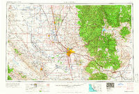
~ Bakersfield CA topo map, 1:250000 scale, 1 X 2 Degree, Historical, 1966, updated 1966
Bakersfield, California, USGS topographic map dated 1966.
Includes geographic coordinates (latitude and longitude). This topographic map is suitable for hiking, camping, and exploring, or framing it as a wall map.
Printed on-demand using high resolution imagery, on heavy weight and acid free paper, or alternatively on a variety of synthetic materials.
Topos available on paper, Waterproof, Poly, or Tyvek. Usually shipping rolled, unless combined with other folded maps in one order.
- Product Number: USGS-5506497
- Free digital map download (high-resolution, GeoPDF): Bakersfield, California (file size: 20 MB)
- Map Size: please refer to the dimensions of the GeoPDF map above
- Weight (paper map): ca. 55 grams
- Map Type: POD USGS Topographic Map
- Map Series: HTMC
- Map Verison: Historical
- Cell ID: 68661
- Scan ID: 299731
- Imprint Year: 1966
- Woodland Tint: Yes
- Field Check Year: 1962
- Datum: Unstated
- Map Projection: Transverse Mercator
- Map published by United States Army Corps of Engineers
- Map published by United States Army
- Map Language: English
- Scanner Resolution: 600 dpi
- Map Cell Name: Bakersfield
- Grid size: 1 X 2 Degree
- Date on map: 1966
- Map Scale: 1:250000
- Geographical region: California, United States
Neighboring Maps:
All neighboring USGS topo maps are available for sale online at a variety of scales.
Spatial coverage:
Topo map Bakersfield, California, covers the geographical area associated the following places:
- Cable - Deer Creek Colony - Buena Vista Mobile Home Park - Kernell - Edmundson Acres - Delano Mobile Home Park - Squirrel Mountain Valley - Stoil - Oil Junction - Wolforts (historical) - Oildale - Pentland - Wible Orchard - Famoso - Sage (historical) - Valley Acres - Kern City - Vinland - Simmler - Caliente - Harpertown - Kyan (historical) - Semitropic - Slater - Una - Terra Bella - Greenfield - Summit - Angiola - Sugarloaf Mountain Park - Alta Sierra - Sageland - East Bakersfield - San Emidio - Patch - Millux - California Hot Springs - Canebrake - Saco - Golden Hills - Wallace Center - Spa (historical) - Missouri Triangle - Idlewild - Pleasant View - Treves (historical) - Zentner - Lake Isabella - Ultra - Burton Mill - Sanborn - Pixley - Stevens - Cawelo - Myricks Corner - Cambio (historical) - Radnor - Calders Corner - Quailwood - Old Town - Fuller Acres - Maltha - Taft Heights - Panorama Heights - Earlimart - Ford City - Bear Valley Springs - Walong - Orris - Cherokee Strip - Lerdo - Fleta - Cinco - Quality - Petersburg (historical) - Rock Springs (historical) - Delano - Claraville - Neuralia (historical) - Cameron - Thomas Lane - Sugarloaf Saw Mill - Taft - Pettit Place - Pumpkin Center - Moreland Mill - Shafter - Mitchells Corner - Millersville - Bannister - Twin Oaks - Trescape (historical) - Dow - Reward - Fig Orchard - Dustin Acres - Glennville - Mountain Mesa - Gold Town (historical) - Greenacres
- Map Area ID: AREA3635-120-118
- Northwest corner Lat/Long code: USGSNW36-120
- Northeast corner Lat/Long code: USGSNE36-118
- Southwest corner Lat/Long code: USGSSW35-120
- Southeast corner Lat/Long code: USGSSE35-118
- Northern map edge Latitude: 36
- Southern map edge Latitude: 35
- Western map edge Longitude: -120
- Eastern map edge Longitude: -118


