
~ Bakersfield CA topo map, 1:250000 scale, 1 X 2 Degree, Historical, 1960, updated 1960
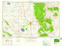
Bakersfield, California, USGS topographic map dated 1960.
Includes geographic coordinates (latitude and longitude). This topographic map is suitable for hiking, camping, and exploring, or framing it as a wall map.
Printed on-demand using high resolution imagery, on heavy weight and acid free paper, or alternatively on a variety of synthetic materials.
Topos available on paper, Waterproof, Poly, or Tyvek. Usually shipping rolled, unless combined with other folded maps in one order.
- Product Number: USGS-5506495
- Free digital map download (high-resolution, GeoPDF): Bakersfield, California (file size: 15 MB)
- Map Size: please refer to the dimensions of the GeoPDF map above
- Weight (paper map): ca. 55 grams
- Map Type: POD USGS Topographic Map
- Map Series: HTMC
- Map Verison: Historical
- Cell ID: 68661
- Scan ID: 299730
- Imprint Year: 1960
- Woodland Tint: Yes
- Aerial Photo Year: 1944
- Datum: Unstated
- Map Projection: Transverse Mercator
- Map published by United States Army Corps of Engineers
- Map published by United States Army
- Map Language: English
- Scanner Resolution: 600 dpi
- Map Cell Name: Bakersfield
- Grid size: 1 X 2 Degree
- Date on map: 1960
- Map Scale: 1:250000
- Geographical region: California, United States
Neighboring Maps:
All neighboring USGS topo maps are available for sale online at a variety of scales.
Spatial coverage:
Topo map Bakersfield, California, covers the geographical area associated the following places:
- Conner - Treves (historical) - Stevens - Minter Village - Sanborn - Delano Mobile Home Park - Kayandee - Lempon (historical) - Pine Flat - Stallion Springs - Five Points - Jastro - Vaccaro (historical) - White River Summer Home Tract - Fram (historical) - Levee (historical) - Millux - Loraine - Greenfield - Fleta - Oildale - Petersburg (historical) - Patch - Una - Wasco - Hights Corner - Mitchells Corner - Quailwood - Ultra - Caliente - Taft - White River - Isabella (historical) - Derby Acres - Neuralia (historical) - Orris - Old Town - Reward - Old River - Oil City - El Rita - Blackwells Corner - Kernell - Elmo - Wallace Center - Mexican Colony - Lerdo - Vestal - San Emidio - Riverkern - Dow - Edmundson Acres - Tupman - Halfway House - Spicer City - Radnor - Lake Isabella - Maricopa - Simmler - Kern Lake - Alta Sierra - Warren (historical) - Venola - Bowerbank - Stoil - Dustin Acres - Mountain Mesa - Miracle Hot Springs - Gulf - Stone Place - Redwood Corral - Saucelito - Leonards (historical) - McKittrick - Bealville - Shady Rest (historical) - Saco - Algoso - Harpertown - Warren (historical) - Fig Orchard - Di Giorgio - Lonsmith - Bear Valley Springs - Allensworth - Cable - Onyx - Lakeview - Cawelo - Gold Town (historical) - Fountain Springs - Shirley Meadows - Asphalto (historical) - California Hot Springs - Shafter - South Taft - Buttonwillow - Crome - Fairview - Little Dixie (historical)
- Map Area ID: AREA3635-120-118
- Northwest corner Lat/Long code: USGSNW36-120
- Northeast corner Lat/Long code: USGSNE36-118
- Southwest corner Lat/Long code: USGSSW35-120
- Southeast corner Lat/Long code: USGSSE35-118
- Northern map edge Latitude: 36
- Southern map edge Latitude: 35
- Western map edge Longitude: -120
- Eastern map edge Longitude: -118


