
~ Bakersfield CA topo map, 1:250000 scale, 1 X 2 Degree, Historical, 1956
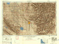
Bakersfield, California, USGS topographic map dated 1956.
Includes geographic coordinates (latitude and longitude). This topographic map is suitable for hiking, camping, and exploring, or framing it as a wall map.
Printed on-demand using high resolution imagery, on heavy weight and acid free paper, or alternatively on a variety of synthetic materials.
Topos available on paper, Waterproof, Poly, or Tyvek. Usually shipping rolled, unless combined with other folded maps in one order.
- Product Number: USGS-5506491
- Free digital map download (high-resolution, GeoPDF): Bakersfield, California (file size: 17 MB)
- Map Size: please refer to the dimensions of the GeoPDF map above
- Weight (paper map): ca. 55 grams
- Map Type: POD USGS Topographic Map
- Map Series: HTMC
- Map Verison: Historical
- Cell ID: 68661
- Scan ID: 299728
- Aerial Photo Year: 1944
- Edit Year: 1956
- Datum: Unstated
- Map Projection: Transverse Mercator
- Map published by United States Army Corps of Engineers
- Map published by United States Army
- Map Language: English
- Scanner Resolution: 600 dpi
- Map Cell Name: Bakersfield
- Grid size: 1 X 2 Degree
- Date on map: 1956
- Map Scale: 1:250000
- Geographical region: California, United States
Neighboring Maps:
All neighboring USGS topo maps are available for sale online at a variety of scales.
Spatial coverage:
Topo map Bakersfield, California, covers the geographical area associated the following places:
- Warren (historical) - Pentland - Onyx - Wheeler Ridge - Kernell - Thomas Lane - Kernville - Paloma (historical) - Vestal - Fram (historical) - Pond - Missouri Triangle - Vinland - Jovista - Alpaugh - Miracle Hot Springs - Jasmin - Palmo - Semitropic - Sageland - Hollis - Spear Creek Summer Home Tract - Arvin Mobile Home Estates - Sage (historical) - Alta Sierra - Venola - Simmler - Elmco - Shady Rest (historical) - Algoso - Poso Park - Pine Flat - Burton Mill - Tehachapi - Riverkern - Monolith - Lerdo - Canebrake - Gulf - Weedpatch - Taft Heights - Wofford Heights - Patch - Piute (historical) - Twin Oaks - Shirley Meadows - Calico - Levee (historical) - Orris - Dow - Famoso - South Lake - Kern Lake - Sand Canyon - Fig Orchard - Stevens - Petersburg (historical) - Chaffee - Midoil - Caliente - Terra Bella - Kern City - Deer Creek Colony - Crome - Quality - Derby Acres - Lackey Place - Fruitvale - Earlimart - Woodford - Valley Acres - Sugarloaf Village - Hazelton - Summit - Isabella (historical) - Vaccaro (historical) - Spicer City - Olig (historical) - Sanborn - Reward - Delano - Weldon - Richgrove - Edison - Ilmon - Lost Hills - Quailwood - Magunden - Bella Vista - Alameda - Wallace Center - Millersville - Claraville - Radnor - Warren (historical) - Cambio (historical) - Inmans (historical) - Saco - Guernsey Mill - Zentner
- Map Area ID: AREA3635-120-118
- Northwest corner Lat/Long code: USGSNW36-120
- Northeast corner Lat/Long code: USGSNE36-118
- Southwest corner Lat/Long code: USGSSW35-120
- Southeast corner Lat/Long code: USGSSE35-118
- Northern map edge Latitude: 36
- Southern map edge Latitude: 35
- Western map edge Longitude: -120
- Eastern map edge Longitude: -118


