
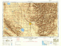
~ Bakersfield CA topo map, 1:250000 scale, 1 X 2 Degree, Historical, 1955, updated 1955
Bakersfield, California, USGS topographic map dated 1955.
Includes geographic coordinates (latitude and longitude). This topographic map is suitable for hiking, camping, and exploring, or framing it as a wall map.
Printed on-demand using high resolution imagery, on heavy weight and acid free paper, or alternatively on a variety of synthetic materials.
Topos available on paper, Waterproof, Poly, or Tyvek. Usually shipping rolled, unless combined with other folded maps in one order.
- Product Number: USGS-5506487
- Free digital map download (high-resolution, GeoPDF): Bakersfield, California (file size: 18 MB)
- Map Size: please refer to the dimensions of the GeoPDF map above
- Weight (paper map): ca. 55 grams
- Map Type: POD USGS Topographic Map
- Map Series: HTMC
- Map Verison: Historical
- Cell ID: 68661
- Scan ID: 299726
- Imprint Year: 1955
- Aerial Photo Year: 1944
- Datum: NAD27
- Map Projection: Transverse Mercator
- Map published by United States Army
- Map Language: English
- Scanner Resolution: 600 dpi
- Map Cell Name: Bakersfield
- Grid size: 1 X 2 Degree
- Date on map: 1955
- Map Scale: 1:250000
- Geographical region: California, United States
Neighboring Maps:
All neighboring USGS topo maps are available for sale online at a variety of scales.
Spatial coverage:
Topo map Bakersfield, California, covers the geographical area associated the following places:
- Lackey Place - Lokern - Harpertown - Conner - Monolith - Lerdo - Buena Vista Mobile Home Park - Arvin Mobile Home Estates - Quailwood - Roads End - Tehachapi - Rosedale - Elmo - Derby Acres - Stoil - Bodfish - Minter Village - Vestal - Inmans (historical) - Glennville - San Emidio - Terra Bella - Weedpatch - Olig (historical) - Algoso - Delano - California Hot Springs - Woodford - Moreland Mill - Golden Hills - Cypress Gardens Mobile Home Community - Halfway House - Angiola - Spicer City - Greenfield - Spa (historical) - Petro (historical) - Loraine - Bella Vista - Kayandee - Richgrove - Quality - Mayfair - North Shafter - Fuller Acres - Kernville (historical) - Old Town - Alta Sierra - Woody - Ilmon - Marcel - Reward - Deer Creek Colony - Paloma (historical) - Kern City - Wolforts (historical) - Shirley Meadows - Vinland - Rowen - South Taft - Semitropic - Sageland - Mountain Mesa - Jastro - Bannister - Cameron - East Bakersfield - Jovista - Twin Oaks - Wallace Center - Sullivan (historical) - Ford City - Gulf - Kyan (historical) - Meridian - Orris - Kernell - Stevens - Old River - Mexican Colony - Little Dixie (historical) - Valley Acres - Maltha - Fleta - Fairview - Lamont - Leonards (historical) - Spellacy - Mettler - Midoil - Balance Rock - Reefer City (historical) - Zentner - Allensworth - Caliente - Oildale - Havilah - Johnsondale - Magunden - Panorama Heights
- Map Area ID: AREA3635-120-118
- Northwest corner Lat/Long code: USGSNW36-120
- Northeast corner Lat/Long code: USGSNE36-118
- Southwest corner Lat/Long code: USGSSW35-120
- Southeast corner Lat/Long code: USGSSE35-118
- Northern map edge Latitude: 36
- Southern map edge Latitude: 35
- Western map edge Longitude: -120
- Eastern map edge Longitude: -118


