
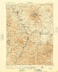
~ Dunsmuir CA topo map, 1:125000 scale, 30 X 30 Minute, Historical, 1935, updated 1948
Dunsmuir, California, USGS topographic map dated 1935.
Includes geographic coordinates (latitude and longitude). This topographic map is suitable for hiking, camping, and exploring, or framing it as a wall map.
Printed on-demand using high resolution imagery, on heavy weight and acid free paper, or alternatively on a variety of synthetic materials.
Topos available on paper, Waterproof, Poly, or Tyvek. Usually shipping rolled, unless combined with other folded maps in one order.
- Product Number: USGS-5505791
- Free digital map download (high-resolution, GeoPDF): Dunsmuir, California (file size: 11 MB)
- Map Size: please refer to the dimensions of the GeoPDF map above
- Weight (paper map): ca. 55 grams
- Map Type: POD USGS Topographic Map
- Map Series: HTMC
- Map Verison: Historical
- Cell ID: 65384
- Scan ID: 299342
- Imprint Year: 1948
- Survey Year: 1931
- Datum: NAD27
- Map Projection: Polyconic
- Map published by United States Geological Survey
- Map Language: English
- Scanner Resolution: 600 dpi
- Map Cell Name: Dunsmuir
- Grid size: 30 X 30 Minute
- Date on map: 1935
- Map Scale: 1:125000
- Geographical region: California, United States
Neighboring Maps:
All neighboring USGS topo maps are available for sale online at a variety of scales.
Spatial coverage:
Topo map Dunsmuir, California, covers the geographical area associated the following places:
- Pioneer - Ash Creek Junction - Conant - Hotlum - Mount Shasta - Esperanza (historical) - Castella - Upton - Howard - Abrams Lake Mobile Estates - Shasta Springs - McCloud - Sims - Riverwood Mobile Home Estates - Warmcastle Mobile Home Park - Azalea - Dunsmuir - Gibson - Carrick - Shadow Mountain Mobile Home Park - Sweetbriar - Wyntoon - Metcalf (historical) - Edgewood - Hooper - Shasta Retreat - Castle Crag - Chateau Shasta Mobile Home Park - Hammond Ranch - Cal-ore Trail Mobile Estates - Cantara (historical) - Deetz - Fisher - Rinckel - Igerna - Weed - Black Butte - Dirigo - Mott - Signal Butte
- Map Area ID: AREA41.541-122.5-122
- Northwest corner Lat/Long code: USGSNW41.5-122.5
- Northeast corner Lat/Long code: USGSNE41.5-122
- Southwest corner Lat/Long code: USGSSW41-122.5
- Southeast corner Lat/Long code: USGSSE41-122
- Northern map edge Latitude: 41.5
- Southern map edge Latitude: 41
- Western map edge Longitude: -122.5
- Eastern map edge Longitude: -122


