
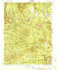
~ Burney CA topo map, 1:125000 scale, 30 X 30 Minute, Historical, 1939, updated 1939
Burney, California, USGS topographic map dated 1939.
Includes geographic coordinates (latitude and longitude). This topographic map is suitable for hiking, camping, and exploring, or framing it as a wall map.
Printed on-demand using high resolution imagery, on heavy weight and acid free paper, or alternatively on a variety of synthetic materials.
Topos available on paper, Waterproof, Poly, or Tyvek. Usually shipping rolled, unless combined with other folded maps in one order.
- Product Number: USGS-5505613
- Free digital map download (high-resolution, GeoPDF): Burney, California (file size: 9 MB)
- Map Size: please refer to the dimensions of the GeoPDF map above
- Weight (paper map): ca. 55 grams
- Map Type: POD USGS Topographic Map
- Map Series: HTMC
- Map Verison: Historical
- Cell ID: 65088
- Scan ID: 299249
- Imprint Year: 1939
- Woodland Tint: Yes
- Survey Year: 1935
- Datum: NAD27
- Map Projection: Polyconic
- Map published by United States Geological Survey
- Map Language: English
- Scanner Resolution: 600 dpi
- Map Cell Name: Burney
- Grid size: 30 X 30 Minute
- Date on map: 1939
- Map Scale: 1:125000
- Geographical region: California, United States
Neighboring Maps:
All neighboring USGS topo maps are available for sale online at a variety of scales.
Spatial coverage:
Topo map Burney, California, covers the geographical area associated the following places:
- Fern - Summertown - Johnson Park - Whittington Place - Viola - Wengler - Round Mountain - Inwood - Doyles Corner - Hat Creek - Hillcrest - Beal Place - Bateman Place - Montgomery Creek - Manzanita Lake - Midway - Four Corners - Cassel - Whitmore - Burney - Redwoods - Eastman Place - Four Corners - Las Colinas Mobile Home Park
- Map Area ID: AREA4140.5-122-121.5
- Northwest corner Lat/Long code: USGSNW41-122
- Northeast corner Lat/Long code: USGSNE41-121.5
- Southwest corner Lat/Long code: USGSSW40.5-122
- Southeast corner Lat/Long code: USGSSE40.5-121.5
- Northern map edge Latitude: 41
- Southern map edge Latitude: 40.5
- Western map edge Longitude: -122
- Eastern map edge Longitude: -121.5


