
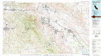
~ Palm Springs CA topo map, 1:100000 scale, 30 X 60 Minute, Historical, 1984, updated 1986
Palm Springs, California, USGS topographic map dated 1984.
Includes geographic coordinates (latitude and longitude). This topographic map is suitable for hiking, camping, and exploring, or framing it as a wall map.
Printed on-demand using high resolution imagery, on heavy weight and acid free paper, or alternatively on a variety of synthetic materials.
Topos available on paper, Waterproof, Poly, or Tyvek. Usually shipping rolled, unless combined with other folded maps in one order.
- Product Number: USGS-5505371
- Free digital map download (high-resolution, GeoPDF): Palm Springs, California (file size: 30 MB)
- Map Size: please refer to the dimensions of the GeoPDF map above
- Weight (paper map): ca. 55 grams
- Map Type: POD USGS Topographic Map
- Map Series: HTMC
- Map Verison: Historical
- Cell ID: 68115
- Scan ID: 299136
- Imprint Year: 1986
- Woodland Tint: Yes
- Visual Version Number: 1
- Aerial Photo Year: 1979
- Edit Year: 1984
- Datum: NAD27
- Map Projection: Universal Transverse Mercator
- Map published by United States Geological Survey
- Map Language: English
- Scanner Resolution: 600 dpi
- Map Cell Name: Palm Springs
- Grid size: 30 X 60 Minute
- Date on map: 1984
- Map Scale: 1:100000
- Geographical region: California, United States
Neighboring Maps:
All neighboring USGS topo maps are available for sale online at a variety of scales.
Spatial coverage:
Topo map Palm Springs, California, covers the geographical area associated the following places:
- Ramona Bowl - White Water - Hemet - Bermuda Palms Mobile Park - Sky Valley - Martinez - Desert Hot Springs - Macomber Palms - Alpine Village - Garnet - La Quinta - Pine Wood - Pushawalla Palms - Indian Wells Mobile Home Park - Myoma (historical) - Desert Hills Trailer Park - Sunnyside Estates - One Hundred Palms - Mons - Oakridge Ranches - Cherry Valley - Palm Desert Country - Thousand Palms - Cahuilla Hills - Edom - Salvia - Rancho Casitas Mobile Home Park - Vista Santa Rosa - Bermuda Dunes - Taylor - Sandy Korner - Pinyon Pines - Rancho Mirage - Pinyon Crest - Bonnie Bell - Shadow Ridge Creek - Royal Palms - Mahoney Trailer Park - Cabazon - Hidden Palms - Coronado Gardens Mobile Home Park - Owl - Fern Valley - Valle Vista - Banning - Valerie - Sage - Suntown - Idyllwild - Thermal - Gilman Hot Springs - Pine Cove - Sycamore Springs - Highland Springs - Caliente Sands - Rimlon - Arroyo Fairways Mobile Home Club - North Palm Springs - Dorado Mobile Home Park - Beaumont - Pueblo del Sol Mobile Park - Saddle Junction - Ribbonwood - Silver Spur Mobile Manor - Anza - Desert Edge - Caleb (historical) - Glenoak Hills - Mountain Center - Sky Valley Mobile Home Park - Desert Groves Mobile Home Park - Arabian Gardens Mobile Home Park - Indio - East Hemet - San Jacinto - Carefree Mobile Village - Sycamore Hills - Thomas Mountain - Biskra Palms - Mecca - Coachella - Snow Creek - Indio Hills - Palm Desert - Palm Springs - Cathedral City - Lake Crest Estates - Willis Palms - Dos Palmas Corners - Soboba Hot Springs - Cahuilla - Indian Wells
- Map Area ID: AREA3433.5-117-116
- Northwest corner Lat/Long code: USGSNW34-117
- Northeast corner Lat/Long code: USGSNE34-116
- Southwest corner Lat/Long code: USGSSW33.5-117
- Southeast corner Lat/Long code: USGSSE33.5-116
- Northern map edge Latitude: 34
- Southern map edge Latitude: 33.5
- Western map edge Longitude: -117
- Eastern map edge Longitude: -116


