
~ Blythe CA topo map, 1:100000 scale, 30 X 60 Minute, Historical, 1986, updated 1986
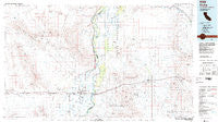
Blythe, California, USGS topographic map dated 1986.
Includes geographic coordinates (latitude and longitude). This topographic map is suitable for hiking, camping, and exploring, or framing it as a wall map.
Printed on-demand using high resolution imagery, on heavy weight and acid free paper, or alternatively on a variety of synthetic materials.
Topos available on paper, Waterproof, Poly, or Tyvek. Usually shipping rolled, unless combined with other folded maps in one order.
- Product Number: USGS-5505217
- Free digital map download (high-resolution, GeoPDF): Blythe, California (file size: 21 MB)
- Map Size: please refer to the dimensions of the GeoPDF map above
- Weight (paper map): ca. 55 grams
- Map Type: POD USGS Topographic Map
- Map Series: HTMC
- Map Verison: Historical
- Cell ID: 67157
- Scan ID: 302035
- Imprint Year: 1986
- Woodland Tint: Yes
- Aerial Photo Year: 1981
- Edit Year: 1986
- Datum: NAD27
- Map Projection: Universal Transverse Mercator
- Map published by United States Geological Survey
- Map Language: English
- Scanner Resolution: 600 dpi
- Map Cell Name: Blythe
- Grid size: 30 X 60 Minute
- Date on map: 1986
- Map Scale: 1:100000
- Geographical region: California, United States
Neighboring Maps:
All neighboring USGS topo maps are available for sale online at a variety of scales.
Spatial coverage:
Topo map Blythe, California, covers the geographical area associated the following places:
- Ehrenberg - Crawfords Trailer Park - River Lagoon Resort Mobile Home Park - Olive City (historical) - Midland - Inca - Blythe Marina Mobile Estates - Tosco (historical) - East Blythe - Mountain Quail Mobile Home Park - Styx - Miller Farms - Mesaville - Quartzsite - Mesa Verde - Ripley - Cox - Plomosa - Morgantown - Poston - La Paz (historical) - Bouse - Blythe - La Paz Valley
- Map Area ID: AREA3433.5-115-114
- Northwest corner Lat/Long code: USGSNW34-115
- Northeast corner Lat/Long code: USGSNE34-114
- Southwest corner Lat/Long code: USGSSW33.5-115
- Southeast corner Lat/Long code: USGSSE33.5-114
- Northern map edge Latitude: 34
- Southern map edge Latitude: 33.5
- Western map edge Longitude: -115
- Eastern map edge Longitude: -114


