
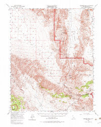
~ Ubehebe Peak CA topo map, 1:62500 scale, 15 X 15 Minute, Historical, 1950, updated 1983
Ubehebe Peak, California, USGS topographic map dated 1950.
Includes geographic coordinates (latitude and longitude). This topographic map is suitable for hiking, camping, and exploring, or framing it as a wall map.
Printed on-demand using high resolution imagery, on heavy weight and acid free paper, or alternatively on a variety of synthetic materials.
Topos available on paper, Waterproof, Poly, or Tyvek. Usually shipping rolled, unless combined with other folded maps in one order.
- Product Number: USGS-5504937
- Free digital map download (high-resolution, GeoPDF): Ubehebe Peak, California (file size: 10 MB)
- Map Size: please refer to the dimensions of the GeoPDF map above
- Weight (paper map): ca. 55 grams
- Map Type: POD USGS Topographic Map
- Map Series: HTMC
- Map Verison: Historical
- Cell ID: 63826
- Scan ID: 301903
- Imprint Year: 1983
- Woodland Tint: Yes
- Aerial Photo Year: 1947
- Field Check Year: 1950
- Datum: NAD27
- Map Projection: Polyconic
- Map published by United States Geological Survey
- Map Language: English
- Scanner Resolution: 600 dpi
- Map Cell Name: Ubehebe Peak
- Grid size: 15 X 15 Minute
- Date on map: 1950
- Map Scale: 1:62500
- Geographical region: California, United States
Neighboring Maps:
All neighboring USGS topo maps are available for sale online at a variety of scales.
Spatial coverage:
Topo map Ubehebe Peak, California, covers the geographical area associated the following places:
- San Lucas Canyon - Ulida Flat - Quail Springs - Bird Spring - Jackass Spring - Lippincott Mine - Ulida Mine - Little Dodd Spring - Jackass Canyon - South Pass - Nelson Range - Lost Burro Mine - The Grandstand - Quail Canyon - Grapevine Canyon - Racetrack Valley - Big Dodd Spring - Blackrock Well - Perdido Canyon - Hunter Mountain - Lost Burro Gap - The Racetrack - Spanish Spring - Ubehebe Mine - Ubehebe Peak - Lee Pump
- Map Area ID: AREA36.7536.5-117.75-117.5
- Northwest corner Lat/Long code: USGSNW36.75-117.75
- Northeast corner Lat/Long code: USGSNE36.75-117.5
- Southwest corner Lat/Long code: USGSSW36.5-117.75
- Southeast corner Lat/Long code: USGSSE36.5-117.5
- Northern map edge Latitude: 36.75
- Southern map edge Latitude: 36.5
- Western map edge Longitude: -117.75
- Eastern map edge Longitude: -117.5


