
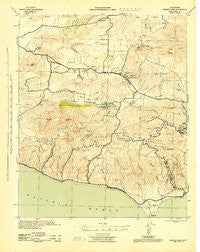
~ Triunfo Pass CA topo map, 1:62500 scale, 15 X 15 Minute, Historical, 1943, updated 1943
Triunfo Pass, California, USGS topographic map dated 1943.
Includes geographic coordinates (latitude and longitude). This topographic map is suitable for hiking, camping, and exploring, or framing it as a wall map.
Printed on-demand using high resolution imagery, on heavy weight and acid free paper, or alternatively on a variety of synthetic materials.
Topos available on paper, Waterproof, Poly, or Tyvek. Usually shipping rolled, unless combined with other folded maps in one order.
- Product Number: USGS-5504851
- Free digital map download (high-resolution, GeoPDF): Triunfo Pass, California (file size: 8 MB)
- Map Size: please refer to the dimensions of the GeoPDF map above
- Weight (paper map): ca. 55 grams
- Map Type: POD USGS Topographic Map
- Map Series: HTMC
- Map Verison: Historical
- Cell ID: 63704
- Scan ID: 301862
- Imprint Year: 1943
- Woodland Tint: Yes
- Aerial Photo Year: 1938
- Datum: NAD27
- Map Projection: Polyconic
- Map published by United States Army Corps of Engineers
- Map published by United States Department of War
- Map Language: English
- Scanner Resolution: 600 dpi
- Map Cell Name: Triunfo Pass
- Grid size: 15 X 15 Minute
- Date on map: 1943
- Map Scale: 1:62500
- Geographical region: California, United States
Neighboring Maps:
All neighboring USGS topo maps are available for sale online at a variety of scales.
Spatial coverage:
Topo map Triunfo Pass, California, covers the geographical area associated the following places:
- Mountclef Village - Agoura Hills - Malibu - Thousand Oaks - Newbury Park - Oak Park - Leisure Village - Trancas - Oak Hill - Solromar - Paradise Cove Mobile Home Park - Point Dume Mobile Home Park - Greenwich Village - North Ranch - Malibu Vista - Cornell - Seminole Hot Springs - Casa Conejo - Malibu Mar Vista (historical) - Mahou Riviera - Conejo Valley Trailer Park - Westlake Village - Malibu Junction - Malibu West - Seminole Springs Trailer Park - Triunfo Corner
- Map Area ID: AREA34.2534-119-118.75
- Northwest corner Lat/Long code: USGSNW34.25-119
- Northeast corner Lat/Long code: USGSNE34.25-118.75
- Southwest corner Lat/Long code: USGSSW34-119
- Southeast corner Lat/Long code: USGSSE34-118.75
- Northern map edge Latitude: 34.25
- Southern map edge Latitude: 34
- Western map edge Longitude: -119
- Eastern map edge Longitude: -118.75


