
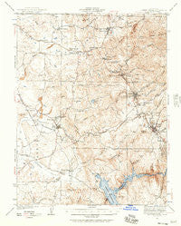
~ Sutter Creek CA topo map, 1:62500 scale, 15 X 15 Minute, Historical, 1941, updated 1957
Sutter Creek, California, USGS topographic map dated 1941.
Includes geographic coordinates (latitude and longitude). This topographic map is suitable for hiking, camping, and exploring, or framing it as a wall map.
Printed on-demand using high resolution imagery, on heavy weight and acid free paper, or alternatively on a variety of synthetic materials.
Topos available on paper, Waterproof, Poly, or Tyvek. Usually shipping rolled, unless combined with other folded maps in one order.
- Product Number: USGS-5504667
- Free digital map download (high-resolution, GeoPDF): Sutter Creek, California (file size: 9 MB)
- Map Size: please refer to the dimensions of the GeoPDF map above
- Weight (paper map): ca. 55 grams
- Map Type: POD USGS Topographic Map
- Map Series: HTMC
- Map Verison: Historical
- Cell ID: 63159
- Scan ID: 301779
- Imprint Year: 1957
- Survey Year: 1941
- Datum: NAD27
- Map Projection: Polyconic
- Map published by United States Geological Survey
- Map published by United States Army Corps of Engineers
- Map Language: English
- Scanner Resolution: 600 dpi
- Map Cell Name: Sutter Creek
- Grid size: 15 X 15 Minute
- Date on map: 1941
- Map Scale: 1:62500
- Geographical region: California, United States
Neighboring Maps:
All neighboring USGS topo maps are available for sale online at a variety of scales.
Spatial coverage:
Topo map Sutter Creek, California, covers the geographical area associated the following places:
- Sunnybrook - Lower Rancheria (historical) - Dagon - Chinatown (historical) - Bonnefoy - Scottsville - Amador City - Paloma - Jackson - Firebrick - Sutter Creek - Sutter Hill - Martell - Ione - Camanche Village - Clarsona - Buena Vista - Forest Home (historical) - Plymouth - Bunker Hill - Drytown - Pokerville (historical) - New Chicago - Edwin
- Map Area ID: AREA38.538.25-121-120.75
- Northwest corner Lat/Long code: USGSNW38.5-121
- Northeast corner Lat/Long code: USGSNE38.5-120.75
- Southwest corner Lat/Long code: USGSSW38.25-121
- Southeast corner Lat/Long code: USGSSE38.25-120.75
- Northern map edge Latitude: 38.5
- Southern map edge Latitude: 38.25
- Western map edge Longitude: -121
- Eastern map edge Longitude: -120.75


