
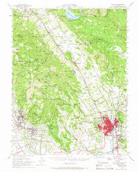
~ Sonoma CA topo map, 1:62500 scale, 15 X 15 Minute, Historical, 1951, updated 1966
Sonoma, California, USGS topographic map dated 1951.
Includes geographic coordinates (latitude and longitude). This topographic map is suitable for hiking, camping, and exploring, or framing it as a wall map.
Printed on-demand using high resolution imagery, on heavy weight and acid free paper, or alternatively on a variety of synthetic materials.
Topos available on paper, Waterproof, Poly, or Tyvek. Usually shipping rolled, unless combined with other folded maps in one order.
- Product Number: USGS-5504583
- Free digital map download (high-resolution, GeoPDF): Sonoma, California (file size: 8 MB)
- Map Size: please refer to the dimensions of the GeoPDF map above
- Weight (paper map): ca. 55 grams
- Map Type: POD USGS Topographic Map
- Map Series: HTMC
- Map Verison: Historical
- Cell ID: 62769
- Scan ID: 301740
- Imprint Year: 1966
- Woodland Tint: Yes
- Aerial Photo Year: 1948
- Survey Year: 1951
- Datum: NAD27
- Map Projection: Polyconic
- Map published by United States Geological Survey
- Map Language: English
- Scanner Resolution: 600 dpi
- Map Cell Name: Sonoma
- Grid size: 15 X 15 Minute
- Date on map: 1951
- Map Scale: 1:62500
- Geographical region: California, United States
Neighboring Maps:
All neighboring USGS topo maps are available for sale online at a variety of scales.
Spatial coverage:
Topo map Sonoma, California, covers the geographical area associated the following places:
- Salvador - Rutherford - Oakville - Verano - Caymus (historical) - Temelec - Oak Knoll - De Anza Moon Valley Mobile Home Park - Pueblo Serena Mobile Home Park - Sonoma - Napa - Agua Caliente - Vineburg - Vichy Springs - Zinfandel - Yountville - Lokoya - Rancho Vista Mobile Home Park - Park Creek Village Mobile Home Park - Buena Vista - Imola - Batto - Mission Highlands - Napa Soda Springs - Union - Four Corners - Bonilla - Thoman - Enchanted Hills - Rocktram - Napa Abajo - Fetters Hot Springs - Rancho Ramon Mobile Home Park - Shipyard Acres - Boyes Hot Springs - El Verano
- Map Area ID: AREA38.538.25-122.5-122.25
- Northwest corner Lat/Long code: USGSNW38.5-122.5
- Northeast corner Lat/Long code: USGSNE38.5-122.25
- Southwest corner Lat/Long code: USGSSW38.25-122.5
- Southeast corner Lat/Long code: USGSSE38.25-122.25
- Northern map edge Latitude: 38.5
- Southern map edge Latitude: 38.25
- Western map edge Longitude: -122.5
- Eastern map edge Longitude: -122.25


