
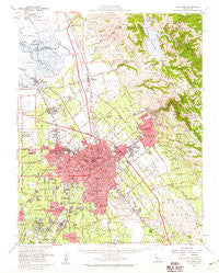
~ San Jose CA topo map, 1:62500 scale, 15 X 15 Minute, Historical, 1953, updated 1959
San Jose, California, USGS topographic map dated 1953.
Includes geographic coordinates (latitude and longitude). This topographic map is suitable for hiking, camping, and exploring, or framing it as a wall map.
Printed on-demand using high resolution imagery, on heavy weight and acid free paper, or alternatively on a variety of synthetic materials.
Topos available on paper, Waterproof, Poly, or Tyvek. Usually shipping rolled, unless combined with other folded maps in one order.
- Product Number: USGS-5504213
- Free digital map download (high-resolution, GeoPDF): San Jose, California (file size: 10 MB)
- Map Size: please refer to the dimensions of the GeoPDF map above
- Weight (paper map): ca. 55 grams
- Map Type: POD USGS Topographic Map
- Map Series: HTMC
- Map Verison: Historical
- Cell ID: 62080
- Scan ID: 301584
- Imprint Year: 1959
- Woodland Tint: Yes
- Aerial Photo Year: 1948
- Survey Year: 1953
- Datum: NAD27
- Map Projection: Polyconic
- Map published by United States Geological Survey
- Map Language: English
- Scanner Resolution: 600 dpi
- Map Cell Name: San Jose
- Grid size: 15 X 15 Minute
- Date on map: 1953
- Map Scale: 1:62500
- Geographical region: California, United States
Neighboring Maps:
All neighboring USGS topo maps are available for sale online at a variety of scales.
Spatial coverage:
Topo map San Jose, California, covers the geographical area associated the following places:
- Johnsville Mobile Home Park - Lamplighter Mobile Home Park - Campbell - Trailer Tel Mobile Home Park - Golden Wheeler Mobile Home Park - Cambrian Park - Casa de Lago Mobile Home Estates - Heinlenville (historical) - Albrae - Milpitas Mobile Home Park - Drawbridge (historical) - Agnew - College Park - Edenvale - Garden Court Mobile Home Village - Riverbend Family Mobile Home Park - Parkmoor - Santa Clara Trailer Village - Willow Glen - Burbank - Wayne - Santa Clara - Garden City Trailer Court - Alamitos - East Foothills - Milpitas - Alviso - Buena Vista - Travelodge Mobile Home Park - Chinatown (historical) - Berryessa - Vasona Junction - Casa Amigo Mobile Home Park - Evergreen - Lawrence - Curtner - Roundup Trailer Lodge - Fruitdale - Meridian - San Jose Mobile Home Park - Adobe Wells Mobile Home Park - Alum Rock - Mobilodge of Milpitas - Warm Springs District - San Jose - Winchester Ranch Mobile Home Park - Seven Trees - Mobile Parks West Mobile Home Park - San Tomas - Robertsville - Lick
- Map Area ID: AREA37.537.25-122-121.75
- Northwest corner Lat/Long code: USGSNW37.5-122
- Northeast corner Lat/Long code: USGSNE37.5-121.75
- Southwest corner Lat/Long code: USGSSW37.25-122
- Southeast corner Lat/Long code: USGSSE37.25-121.75
- Northern map edge Latitude: 37.5
- Southern map edge Latitude: 37.25
- Western map edge Longitude: -122
- Eastern map edge Longitude: -121.75


