
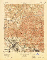
~ San Fernando CA topo map, 1:62500 scale, 15 X 15 Minute, Historical, 1945, updated 1945
San Fernando, California, USGS topographic map dated 1945.
Includes geographic coordinates (latitude and longitude). This topographic map is suitable for hiking, camping, and exploring, or framing it as a wall map.
Printed on-demand using high resolution imagery, on heavy weight and acid free paper, or alternatively on a variety of synthetic materials.
Topos available on paper, Waterproof, Poly, or Tyvek. Usually shipping rolled, unless combined with other folded maps in one order.
- Product Number: USGS-5504185
- Free digital map download (high-resolution, GeoPDF): San Fernando, California (file size: 13 MB)
- Map Size: please refer to the dimensions of the GeoPDF map above
- Weight (paper map): ca. 55 grams
- Map Type: POD USGS Topographic Map
- Map Series: HTMC
- Map Verison: Historical
- Cell ID: 62076
- Scan ID: 298888
- Imprint Year: 1945
- Woodland Tint: Yes
- Aerial Photo Year: 1940
- Survey Year: 1897
- Datum: NAD27
- Map Projection: Polyconic
- Map published by United States Army Corps of Engineers
- Map published by United States Department of War
- Map Language: English
- Scanner Resolution: 600 dpi
- Map Cell Name: San Fernando
- Grid size: 15 X 15 Minute
- Date on map: 1945
- Map Scale: 1:62500
- Geographical region: California, United States
Neighboring Maps:
All neighboring USGS topo maps are available for sale online at a variety of scales.
Spatial coverage:
Topo map San Fernando, California, covers the geographical area associated the following places:
- Lake View Terrace - Tujunga - Humphreys - El Merrie Dell - Alpine (historical) - Sylmar - Canyon Country - Agua Dulce - Stonehurst - Olive View - Soledad Sulphur Springs (historical) - Indian Springs - Pacoima - Shadow Hills - Forest Park - Mission Hills - Honby - Mint Canyon - Solemint - Kagel Canyon - Lang - Russ - Sunland - Hickson - San Fernando
- Map Area ID: AREA34.534.25-118.5-118.25
- Northwest corner Lat/Long code: USGSNW34.5-118.5
- Northeast corner Lat/Long code: USGSNE34.5-118.25
- Southwest corner Lat/Long code: USGSSW34.25-118.5
- Southeast corner Lat/Long code: USGSSE34.25-118.25
- Northern map edge Latitude: 34.5
- Southern map edge Latitude: 34.25
- Western map edge Longitude: -118.5
- Eastern map edge Longitude: -118.25


