
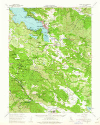
~ Lower Lake CA topo map, 1:62500 scale, 15 X 15 Minute, Historical, 1958, updated 1962
Lower Lake, California, USGS topographic map dated 1958.
Includes geographic coordinates (latitude and longitude). This topographic map is suitable for hiking, camping, and exploring, or framing it as a wall map.
Printed on-demand using high resolution imagery, on heavy weight and acid free paper, or alternatively on a variety of synthetic materials.
Topos available on paper, Waterproof, Poly, or Tyvek. Usually shipping rolled, unless combined with other folded maps in one order.
- Product Number: USGS-5502781
- Free digital map download (high-resolution, GeoPDF): Lower Lake, California (file size: 9 MB)
- Map Size: please refer to the dimensions of the GeoPDF map above
- Weight (paper map): ca. 55 grams
- Map Type: POD USGS Topographic Map
- Map Series: HTMC
- Map Verison: Historical
- Cell ID: 56949
- Scan ID: 298073
- Imprint Year: 1962
- Woodland Tint: Yes
- Datum: NAD27
- Map Projection: Polyconic
- Map published by United States Geological Survey
- Map Language: English
- Scanner Resolution: 600 dpi
- Map Cell Name: Lower Lake
- Grid size: 15 X 15 Minute
- Date on map: 1958
- Map Scale: 1:62500
- Geographical region: California, United States
Neighboring Maps:
All neighboring USGS topo maps are available for sale online at a variety of scales.
Spatial coverage:
Topo map Lower Lake, California, covers the geographical area associated the following places:
- Castle Rock Springs - Ettawa Springs - Hidden Valley Lake - Bonanza Springs - Harbin Springs Annex - Loch Lomond - Salminas Resort - Clearlake - Forest Lake - Lower Lake - Clearlake Highlands - Seigler Springs - Harbin Springs - Middletown - Guenoc (historical) - Whispering Pines - Adams - Sunrise Vista - Cobb - Hobergs - Clear Lake Riviera - Clearlake Park - Twin Lakes - Howard Springs - Pine Grove - Mount Hannah Lodge - Riviera West - Riviera Estates
- Map Area ID: AREA3938.75-122.75-122.5
- Northwest corner Lat/Long code: USGSNW39-122.75
- Northeast corner Lat/Long code: USGSNE39-122.5
- Southwest corner Lat/Long code: USGSSW38.75-122.75
- Southeast corner Lat/Long code: USGSSE38.75-122.5
- Northern map edge Latitude: 39
- Southern map edge Latitude: 38.75
- Western map edge Longitude: -122.75
- Eastern map edge Longitude: -122.5


