
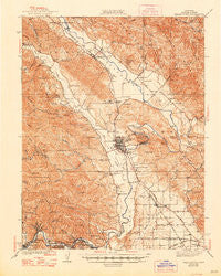
~ Healdsburg CA topo map, 1:62500 scale, 15 X 15 Minute, Historical, 1940, updated 1948
Healdsburg, California, USGS topographic map dated 1940.
Includes geographic coordinates (latitude and longitude). This topographic map is suitable for hiking, camping, and exploring, or framing it as a wall map.
Printed on-demand using high resolution imagery, on heavy weight and acid free paper, or alternatively on a variety of synthetic materials.
Topos available on paper, Waterproof, Poly, or Tyvek. Usually shipping rolled, unless combined with other folded maps in one order.
- Product Number: USGS-5502103
- Free digital map download (high-resolution, GeoPDF): Healdsburg, California (file size: 11 MB)
- Map Size: please refer to the dimensions of the GeoPDF map above
- Weight (paper map): ca. 55 grams
- Map Type: POD USGS Topographic Map
- Map Series: HTMC
- Map Verison: Historical
- Cell ID: 55206
- Scan ID: 297673
- Imprint Year: 1948
- Survey Year: 1933
- Datum: NAD27
- Map Projection: Polyconic
- Map published by United States Geological Survey
- Map Language: English
- Scanner Resolution: 600 dpi
- Map Cell Name: Healdsburg
- Grid size: 15 X 15 Minute
- Date on map: 1940
- Map Scale: 1:62500
- Geographical region: California, United States
Neighboring Maps:
All neighboring USGS topo maps are available for sale online at a variety of scales.
Spatial coverage:
Topo map Healdsburg, California, covers the geographical area associated the following places:
- Mount Jackson - Wilson Grove - Korbel - Hilton - Forest Hills - Grant - Jimtown - Camp Rose - Hollydale - Geyserville - Lytton - Cozzens Corner - Guerneville - Del Rio Woods - El Bonita - Bailhache - Healdsburg - Wikiup - Russian River Terrace - Hacienda - Omus - Windsor - Shiloh - East Windsor - Rio Nido - Rolands - Chianti - Highcroft - Chiquita - Odd Fellows Park - Simi - Nervo
- Map Area ID: AREA38.7538.5-123-122.75
- Northwest corner Lat/Long code: USGSNW38.75-123
- Northeast corner Lat/Long code: USGSNE38.75-122.75
- Southwest corner Lat/Long code: USGSSW38.5-123
- Southeast corner Lat/Long code: USGSSE38.5-122.75
- Northern map edge Latitude: 38.75
- Southern map edge Latitude: 38.5
- Western map edge Longitude: -123
- Eastern map edge Longitude: -122.75


