
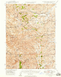
~ Colyear Springs CA topo map, 1:62500 scale, 15 X 15 Minute, Historical, 1949
Colyear Springs, California, USGS topographic map dated 1949.
Includes geographic coordinates (latitude and longitude). This topographic map is suitable for hiking, camping, and exploring, or framing it as a wall map.
Printed on-demand using high resolution imagery, on heavy weight and acid free paper, or alternatively on a variety of synthetic materials.
Topos available on paper, Waterproof, Poly, or Tyvek. Usually shipping rolled, unless combined with other folded maps in one order.
- Product Number: USGS-5501167
- Free digital map download (high-resolution, GeoPDF): Colyear Springs, California (file size: 12 MB)
- Map Size: please refer to the dimensions of the GeoPDF map above
- Weight (paper map): ca. 55 grams
- Map Type: POD USGS Topographic Map
- Map Series: HTMC
- Map Verison: Historical
- Cell ID: 52846
- Scan ID: 297151
- Woodland Tint: Yes
- Aerial Photo Year: 1941
- Survey Year: 1945
- Datum: NAD27
- Map Projection: Polyconic
- Map published by United States Geological Survey
- Map published by United States Army Corps of Engineers
- Map Language: English
- Scanner Resolution: 600 dpi
- Map Cell Name: Colyear Springs
- Grid size: 15 X 15 Minute
- Date on map: 1949
- Map Scale: 1:62500
- Geographical region: California, United States
Neighboring Maps:
All neighboring USGS topo maps are available for sale online at a variety of scales.
Spatial coverage:
Topo map Colyear Springs, California, covers the geographical area associated the following places:
- Alford Place - Leonard Place (historical) - Shackleford Place - Banfield Place - Gilliam Place - Westend Galatin Place (historical) - Heitman Place (historical) - Walker Place (historical) - Pettyjohn Place - Saunders Place - Cold Fork - Pete Hoff Place - Hammer Place - Swain Place - Copple Place - Montgomery Place - Skinner Mill Place - Hatfield Place (historical) - Irish Place (historical) - Watson - Bayles Place - Hercraff Place - Brown Place - Mary Ellen Place - Lowrey - McCartney Place - Haven Place - Fowler Place
- Map Area ID: AREA40.2540-122.75-122.5
- Northwest corner Lat/Long code: USGSNW40.25-122.75
- Northeast corner Lat/Long code: USGSNE40.25-122.5
- Southwest corner Lat/Long code: USGSSW40-122.75
- Southeast corner Lat/Long code: USGSSE40-122.5
- Northern map edge Latitude: 40.25
- Southern map edge Latitude: 40
- Western map edge Longitude: -122.75
- Eastern map edge Longitude: -122.5


