
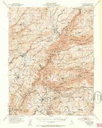
~ Columbia CA topo map, 1:62500 scale, 15 X 15 Minute, Historical, 1948, updated 1953
Columbia, California, USGS topographic map dated 1948.
Includes geographic coordinates (latitude and longitude). This topographic map is suitable for hiking, camping, and exploring, or framing it as a wall map.
Printed on-demand using high resolution imagery, on heavy weight and acid free paper, or alternatively on a variety of synthetic materials.
Topos available on paper, Waterproof, Poly, or Tyvek. Usually shipping rolled, unless combined with other folded maps in one order.
- Product Number: USGS-5501153
- Free digital map download (high-resolution, GeoPDF): Columbia, California (file size: 11 MB)
- Map Size: please refer to the dimensions of the GeoPDF map above
- Weight (paper map): ca. 55 grams
- Map Type: POD USGS Topographic Map
- Map Series: HTMC
- Map Verison: Historical
- Cell ID: 52830
- Scan ID: 297142
- Imprint Year: 1953
- Visual Version Number: 1
- Aerial Photo Year: 1946
- Field Check Year: 1948
- Datum: NAD27
- Map Projection: Polyconic
- Map published by United States Geological Survey
- Map Language: English
- Scanner Resolution: 600 dpi
- Map Cell Name: Columbia
- Grid size: 15 X 15 Minute
- Date on map: 1948
- Map Scale: 1:62500
- Geographical region: California, United States
Neighboring Maps:
All neighboring USGS topo maps are available for sale online at a variety of scales.
Spatial coverage:
Topo map Columbia, California, covers the geographical area associated the following places:
- Canyon View - Hanford Hill - Apple Valley Estates - Cuesta Oaks - Avery - Vallecito - Hathaway Pines - Sunset Point - Timber Trails - Indian Creek - Rocky Hill - Meadowmont - Phoenix Lake County Club Estates - Indian Hills - Scenic Heights - Douglas Flat - Wyldewood - Chaparral Heights - Comstock Ranch - Lakemont Pines - Yankee Hill - Columbia - Cedar Vista - Phoenix Lake - Jupiter - Martinez - Red Apple - Squabbletown - Saratoga Acres - Hathaways Mountain Pines - Sonora Meadows - Ponderosa Park - McKay - Big Valley - Fisher Place - Forest Meadows - Belleview - Bellwood Estates - Stanislaus - Springfield - Murphys - Crystal Falls - Shaws Flat - Melones - Ebbetts Pass Highlands - Sheep Ranch - La Honda Park - Cedar Ridge - Pinebrook - Goldmont Forest - Fly-In Acres - Browns Flat - Belleview Acres - Columbia Village - White Oak Estates - Douds Landing
- Map Area ID: AREA38.2538-120.5-120.25
- Northwest corner Lat/Long code: USGSNW38.25-120.5
- Northeast corner Lat/Long code: USGSNE38.25-120.25
- Southwest corner Lat/Long code: USGSSW38-120.5
- Southeast corner Lat/Long code: USGSSE38-120.25
- Northern map edge Latitude: 38.25
- Southern map edge Latitude: 38
- Western map edge Longitude: -120.5
- Eastern map edge Longitude: -120.25


