
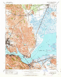
~ Carquinez Strait CA topo map, 1:62500 scale, 15 X 15 Minute, Historical, 1940, updated 1963
Carquinez Strait, California, USGS topographic map dated 1940.
Includes geographic coordinates (latitude and longitude). This topographic map is suitable for hiking, camping, and exploring, or framing it as a wall map.
Printed on-demand using high resolution imagery, on heavy weight and acid free paper, or alternatively on a variety of synthetic materials.
Topos available on paper, Waterproof, Poly, or Tyvek. Usually shipping rolled, unless combined with other folded maps in one order.
- Product Number: USGS-5500959
- Free digital map download (high-resolution, GeoPDF): Carquinez Strait, California (file size: 10 MB)
- Map Size: please refer to the dimensions of the GeoPDF map above
- Weight (paper map): ca. 55 grams
- Map Type: POD USGS Topographic Map
- Map Series: HTMC
- Map Verison: Historical
- Cell ID: 52202
- Scan ID: 297036
- Imprint Year: 1963
- Woodland Tint: Yes
- Datum: NAD27
- Map Projection: Polyconic
- Map published by United States Army Corps of Engineers
- Map published by United States Department of War
- Map Language: English
- Scanner Resolution: 600 dpi
- Map Cell Name: Carquinez Strait
- Grid size: 15 X 15 Minute
- Date on map: 1940
- Map Scale: 1:62500
- Geographical region: California, United States
Neighboring Maps:
All neighboring USGS topo maps are available for sale online at a variety of scales.
Spatial coverage:
Topo map Carquinez Strait, California, covers the geographical area associated the following places:
- Carquinez Heights - Martinez - Oleum - Clima - Suval - Selby - Tormey - Ohmer (historical) - Mountain View - Eckley - Valona - Sulphur Springs (historical) - Bahia - Crolona Heights - Harry Floyd Terrace - Chadbourne - Teal - Willota - Port Costa - Benicia - Cordelia Junction - Christie - Chabot Terrace - Cordelia - Rockville - Creston - Pierce - Russell - Glencove - Clyde - Vine Hill - Danielson - Avon - South Vallejo - Monsanto - Crockett - Ozol - Maltby - Suisun - Port Chicago (historical) - Subeet - Fairfield - Mococo - Thomasson - Jacksnipe - Cygnus
- Map Area ID: AREA38.2538-122.25-122
- Northwest corner Lat/Long code: USGSNW38.25-122.25
- Northeast corner Lat/Long code: USGSNE38.25-122
- Southwest corner Lat/Long code: USGSSW38-122.25
- Southeast corner Lat/Long code: USGSSE38-122
- Northern map edge Latitude: 38.25
- Southern map edge Latitude: 38
- Western map edge Longitude: -122.25
- Eastern map edge Longitude: -122


