
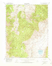
~ Blanco Mountain CA topo map, 1:62500 scale, 15 X 15 Minute, Historical, 1951, updated 1973
Blanco Mountain, California, USGS topographic map dated 1951.
Includes geographic coordinates (latitude and longitude). This topographic map is suitable for hiking, camping, and exploring, or framing it as a wall map.
Printed on-demand using high resolution imagery, on heavy weight and acid free paper, or alternatively on a variety of synthetic materials.
Topos available on paper, Waterproof, Poly, or Tyvek. Usually shipping rolled, unless combined with other folded maps in one order.
- Product Number: USGS-5500601
- Free digital map download (high-resolution, GeoPDF): Blanco Mountain, California (file size: 9 MB)
- Map Size: please refer to the dimensions of the GeoPDF map above
- Weight (paper map): ca. 55 grams
- Map Type: POD USGS Topographic Map
- Map Series: HTMC
- Map Verison: Historical
- Cell ID: 51510
- Scan ID: 296837
- Imprint Year: 1973
- Woodland Tint: Yes
- Aerial Photo Year: 1947
- Field Check Year: 1951
- Datum: NAD27
- Map Projection: Polyconic
- Map published by United States Geological Survey
- Map Language: English
- Scanner Resolution: 600 dpi
- Map Cell Name: Blanco Mountain
- Grid size: 15 X 15 Minute
- Date on map: 1951
- Map Scale: 1:62500
- Geographical region: California, United States
Neighboring Maps:
All neighboring USGS topo maps are available for sale online at a variety of scales.
Spatial coverage:
Topo map Blanco Mountain, California, covers the geographical area associated the following places:
- Reed Flat - Wilkerson Mine - Sierra View - Sage Hen Flat - Grandview Mine - Schulman Grove Picnic Area - Schulman-Methusalah Trailhead - Crystal Peak - Roberts Ridge - Cuña Spring - Big Prospector Meadow - Camp Bristlecone - Buckhorn Springs - Schulman Grove - Methuselah Trail - Mollie Gibson Mines - Antelope Spring - Roberts Ranch - Log Canyon - Black Birch Canyon - Bristlecone Visitor Center - County Line Hill - North Fork Crooked Creek - Crooked Creek - Dead Horse Meadow - Black Canyon Mine - Ancient Bristlecone Pine Forest - KIBS-FM (Bishop) - Grandview Campground - Gray Eagle Mine - Royal Gorge - Black Mountain - Arrastre Meadow - Bucks Peak - Blanco Mountain - Big Pine Kiosk - Cedar Flat - Clem Nelson Peak - Bog Mound Springs - Payson Canyon - Sams Spring - Deep Springs Valley - Corral Springs - The Elephant - Index Hill - Mill Canyon - Southbend Mine - Cedar Spring - Poleta Campground - Mexican Mine - Cedar Flat Entrance Station - Iron Mountain - White Mountain Research Station - Montenegro Spring - Deep Springs Lake - Schulman Grove Visitor Center - South Fork Crooked Creek - Juniper Campground - See Remarks - Westgard Pass - Marble Canyon - North Fork Birch Creek - South Fork Birch Creek - Mollie Gibson Canyon - Sage Hen Peak - Black Canyon Spring - Discovery Trail - Pinon Campground - Goat Spring - Coldwater Spring - Sentinal Peak - Red Peak - Campito Mountain - Birch Creek - Fossil Campground - Pinon Picnic Area - Beer Creek - Water Canyon - Schulman Grove Picnic Site
- Map Area ID: AREA37.537.25-118.25-118
- Northwest corner Lat/Long code: USGSNW37.5-118.25
- Northeast corner Lat/Long code: USGSNE37.5-118
- Southwest corner Lat/Long code: USGSSW37.25-118.25
- Southeast corner Lat/Long code: USGSSE37.25-118
- Northern map edge Latitude: 37.5
- Southern map edge Latitude: 37.25
- Western map edge Longitude: -118.25
- Eastern map edge Longitude: -118


