
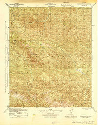
~ Strawberry Peak CA topo map, 1:31680 scale, 7.5 X 7.5 Minute, Historical, 1944, updated 1944
Strawberry Peak, California, USGS topographic map dated 1944.
Includes geographic coordinates (latitude and longitude). This topographic map is suitable for hiking, camping, and exploring, or framing it as a wall map.
Printed on-demand using high resolution imagery, on heavy weight and acid free paper, or alternatively on a variety of synthetic materials.
Topos available on paper, Waterproof, Poly, or Tyvek. Usually shipping rolled, unless combined with other folded maps in one order.
- Product Number: USGS-5500061
- Free digital map download (high-resolution, GeoPDF): Strawberry Peak, California (file size: 12 MB)
- Map Size: please refer to the dimensions of the GeoPDF map above
- Weight (paper map): ca. 55 grams
- Map Type: POD USGS Topographic Map
- Map Series: HTMC
- Map Verison: Historical
- Cell ID: 27220
- Scan ID: 301533
- Imprint Year: 1944
- Woodland Tint: Yes
- Aerial Photo Year: 1942
- Datum: NAD27
- Map Projection: Polyconic
- Map published by United States Army Corps of Engineers
- Map published by United States Department of War
- Map Language: English
- Scanner Resolution: 600 dpi
- Map Cell Name: Madulce Peak
- Grid size: 7.5 X 7.5 Minute
- Date on map: 1944
- Map Scale: 1:31680
- Geographical region: California, United States
Neighboring Maps:
All neighboring USGS topo maps are available for sale online at a variety of scales.
Spatial coverage:
Topo map Strawberry Peak, California, covers the geographical area associated the following places:
- Choke Cherry Spring - Alamar Hill - Bill Farris Campground - Pine Canyon - Dick Smith Wilderness - Lacosca Creek - Dutch Oven Campground - The Caracole - Upper Mono Trail - Lower Alamar Campground - Madulce Guard Station - Loma Pelona - Don Victor Canyon - Puerta Suela - Madulce Peak - Alamar Trail - Madulce Rustic Campsite - Bear Creek - Don Victor Campground - Chokecherry Canyon - Don Victor Valley - Pine Canyon Campground - Alamar Hill Trail - Madulce Trail
- Map Area ID: AREA34.7534.625-119.625-119.5
- Northwest corner Lat/Long code: USGSNW34.75-119.625
- Northeast corner Lat/Long code: USGSNE34.75-119.5
- Southwest corner Lat/Long code: USGSSW34.625-119.625
- Southeast corner Lat/Long code: USGSSE34.625-119.5
- Northern map edge Latitude: 34.75
- Southern map edge Latitude: 34.625
- Western map edge Longitude: -119.625
- Eastern map edge Longitude: -119.5


