
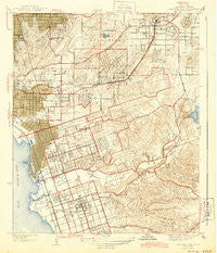
~ National City CA topo map, 1:31680 scale, 7.5 X 7.5 Minute, Historical, 1944
National City, California, USGS topographic map dated 1944.
Includes geographic coordinates (latitude and longitude). This topographic map is suitable for hiking, camping, and exploring, or framing it as a wall map.
Printed on-demand using high resolution imagery, on heavy weight and acid free paper, or alternatively on a variety of synthetic materials.
Topos available on paper, Waterproof, Poly, or Tyvek. Usually shipping rolled, unless combined with other folded maps in one order.
- Product Number: USGS-5499731
- Free digital map download (high-resolution, GeoPDF): National City, California (file size: 9 MB)
- Map Size: please refer to the dimensions of the GeoPDF map above
- Weight (paper map): ca. 55 grams
- Map Type: POD USGS Topographic Map
- Map Series: HTMC
- Map Verison: Historical
- Cell ID: 31388
- Scan ID: 296337
- Survey Year: 1939
- Datum: NAD27
- Map Projection: Polyconic
- Map published by United States Geological Survey
- Map Language: English
- Scanner Resolution: 600 dpi
- Map Cell Name: National City
- Grid size: 7.5 X 7.5 Minute
- Date on map: 1944
- Map Scale: 1:31680
- Geographical region: California, United States
Neighboring Maps:
All neighboring USGS topo maps are available for sale online at a variety of scales.
Spatial coverage:
Topo map National City, California, covers the geographical area associated the following places:
- National City - Lincoln Acres - Emerald Hills - Encanto - Rancho del Rey - Chollas View - Mount Hope - East San Diego - Lincoln Park - Mountain View - North Bay Terraces - Stockton - Lynwood Hills - Chollas Creek - Chula Vista - Lomita - Valencia Park - South Crest - South Encantato - Bonita - Sunny Vista - Sunnyside - Paradise Hills - Shelltown - South Bay Terraces - Lemon Grove
- Map Area ID: AREA32.7532.625-117.125-117
- Northwest corner Lat/Long code: USGSNW32.75-117.125
- Northeast corner Lat/Long code: USGSNE32.75-117
- Southwest corner Lat/Long code: USGSSW32.625-117.125
- Southeast corner Lat/Long code: USGSSE32.625-117
- Northern map edge Latitude: 32.75
- Southern map edge Latitude: 32.625
- Western map edge Longitude: -117.125
- Eastern map edge Longitude: -117


