
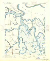
~ Bouldin CA topo map, 1:31680 scale, 7.5 X 7.5 Minute, Historical, 1910, updated 1947
Bouldin, California, USGS topographic map dated 1910.
Includes geographic coordinates (latitude and longitude). This topographic map is suitable for hiking, camping, and exploring, or framing it as a wall map.
Printed on-demand using high resolution imagery, on heavy weight and acid free paper, or alternatively on a variety of synthetic materials.
Topos available on paper, Waterproof, Poly, or Tyvek. Usually shipping rolled, unless combined with other folded maps in one order.
- Product Number: USGS-5499051
- Free digital map download (high-resolution, GeoPDF): Bouldin, California (file size: 6 MB)
- Map Size: please refer to the dimensions of the GeoPDF map above
- Weight (paper map): ca. 55 grams
- Map Type: POD USGS Topographic Map
- Map Series: HTMC
- Map Verison: Historical
- Cell ID: 69422
- Scan ID: 295945
- Imprint Year: 1947
- Survey Year: 1908
- Datum: NAD
- Map Projection: Polyconic
- Map published by United States Geological Survey
- Map Language: English
- Scanner Resolution: 600 dpi
- Map Cell Name: Bouldin Island
- Grid size: 7.5 X 7.5 Minute
- Date on map: 1910
- Map Scale: 1:31680
- Geographical region: California, United States
Neighboring Maps:
All neighboring USGS topo maps are available for sale online at a variety of scales.
Spatial coverage:
Topo map Bouldin, California, covers the geographical area associated the following places:
- Prisoners Point Bend Light (historical) - Potato Point - Connection Slough - Old River - Venice Cut - Venice Island - Webb Point - San Andreas Shoal - Criminal Slough - Prisoners Point - Venice Ferry - Mokelumne River - Ward Island - Burns Reach - Venice-Mandeville School (historical) - Middle River - Turner Slough (historical) - Stockton Deep Water Channel - Potato Slough - Webb Tract - Webb Reach - Medford Island - Bouldin Island - Sacramento County Sheriff - Brannan Island Service Center - Turner Lake (historical) - Roosevelt Cut - Hayes Point - Mandeville Island - Sand Mound Slough - Three River Reach - Columbia Cut - Little Mandeville Island - Hayes Reach - Quimby Island - Mandeville Point - Holland Cut - Little Venice Island - Nibs Slough - Mandeville Tip County Park - Mandeville Cut - Beaver Slough - Mandeville Reach - Singapore Cut - Short Slough - Blakes Landing - Central Landing - Venice Reach - Rhode Island - Sheep Slough
- Map Area ID: AREA38.12538-121.625-121.5
- Northwest corner Lat/Long code: USGSNW38.125-121.625
- Northeast corner Lat/Long code: USGSNE38.125-121.5
- Southwest corner Lat/Long code: USGSSW38-121.625
- Southeast corner Lat/Long code: USGSSE38-121.5
- Northern map edge Latitude: 38.125
- Southern map edge Latitude: 38
- Western map edge Longitude: -121.625
- Eastern map edge Longitude: -121.5


