
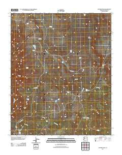
~ Sunrise Peak AZ topo map, 1:24000 scale, 7.5 X 7.5 Minute, Historical, 2011
Sunrise Peak, Arizona, USGS topographic map dated 2011.
Includes geographic coordinates (latitude and longitude). This topographic map is suitable for hiking, camping, and exploring, or framing it as a wall map.
Printed on-demand using high resolution imagery, on heavy weight and acid free paper, or alternatively on a variety of synthetic materials.
Topos available on paper, Waterproof, Poly, or Tyvek. Usually shipping rolled, unless combined with other folded maps in one order.
- Product Number: USGS-5497209
- Free digital map download (high-resolution, GeoPDF): Sunrise Peak, Arizona (file size: 23 MB)
- Map Size: please refer to the dimensions of the GeoPDF map above
- Weight (paper map): ca. 55 grams
- Map Type: POD USGS Topographic Map
- Map Series: US Topo
- Map Verison: Historical
- Cell ID: 43852
- Datum: North American Datum of 1983
- Map Projection: Transverse Mercator
- Map Cell Name: Sunrise Peak
- Grid size: 7.5 X 7.5 Minute
- Date on map: 2011
- Map Scale: 1:24000
- Geographical region: Arizona, United States
Neighboring Maps:
All neighboring USGS topo maps are available for sale online at a variety of scales.
Spatial coverage:
Topo map Sunrise Peak, Arizona, covers the geographical area associated the following places:
- Cripple Cat Tank - Encino Tank - Big Ikie Tank - Sheep Creek - Rimrock Tank - Triangle N Tank - Sheep Tank - Illa Tank - Jolly Tank - Walker Tank - West Mesa - Wildman Tank - Cherry Tree Tank - Cottonwood Tank - West Mesa Tank - Sunrise Peak - Jackass Basin - Oak Tank - Triangle N Canyon - Malpais Tank - West Split Tank - Well Number Six - Indian Hill - Jones Tank - Johnson Flat - Brett Tank - Bear Creek Camp - Triangle N Camp - Moffit Canyon - Bobs Tank - Sunrise Spring - Bear Creek Tank - Little Cottonwood Tank
- Map Area ID: AREA3534.875-113.25-113.125
- Northwest corner Lat/Long code: USGSNW35-113.25
- Northeast corner Lat/Long code: USGSNE35-113.125
- Southwest corner Lat/Long code: USGSSW34.875-113.25
- Southeast corner Lat/Long code: USGSSE34.875-113.125
- Northern map edge Latitude: 35
- Southern map edge Latitude: 34.875
- Western map edge Longitude: -113.25
- Eastern map edge Longitude: -113.125


