
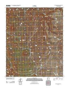
~ Gonzales Wash AZ topo map, 1:24000 scale, 7.5 X 7.5 Minute, Historical, 2011
Gonzales Wash, Arizona, USGS topographic map dated 2011.
Includes geographic coordinates (latitude and longitude). This topographic map is suitable for hiking, camping, and exploring, or framing it as a wall map.
Printed on-demand using high resolution imagery, on heavy weight and acid free paper, or alternatively on a variety of synthetic materials.
Topos available on paper, Waterproof, Poly, or Tyvek. Usually shipping rolled, unless combined with other folded maps in one order.
- Product Number: USGS-5497161
- Free digital map download (high-resolution, GeoPDF): Gonzales Wash, Arizona (file size: 25 MB)
- Map Size: please refer to the dimensions of the GeoPDF map above
- Weight (paper map): ca. 55 grams
- Map Type: POD USGS Topographic Map
- Map Series: US Topo
- Map Verison: Historical
- Cell ID: 17679
- Datum: North American Datum of 1983
- Map Projection: Transverse Mercator
- Map Cell Name: Gonzales Wash
- Grid size: 7.5 X 7.5 Minute
- Date on map: 2011
- Map Scale: 1:24000
- Geographical region: Arizona, United States
Neighboring Maps:
All neighboring USGS topo maps are available for sale online at a variety of scales.
Spatial coverage:
Topo map Gonzales Wash, Arizona, covers the geographical area associated the following places:
- Coters Tank - Winslow Canyon - Antelope Tank - Lower Simmons Well - Dividing Canyon - Cabezas Spring - Wagon Canyon - Horseshoe Tank - Little Mesa - Simmons Gulch - Lower Basin - Indian Spring - Upper Hidden Simmons Gonzales - Coyote Spring - Upper Tom Brown Well - Simmons Spring - Gonzales Wash - Red Canyon - Lower Simmons Peak - Wagon Bow Ranch - Black Butte Tank - Hidden Tank - Skunk Canyon Spring - Gonzales Spring - Eds Tank - Winslow Tank - Wagon Canyon Spring - Parsons Field - Pipeline Tank - Little Mesa Tank - Skunk Canyon - Upper Spring - Lower Basin Spring - Gonzales Canyon - Upper Simmons Well - Island Tank
- Map Area ID: AREA3534.875-113.5-113.375
- Northwest corner Lat/Long code: USGSNW35-113.5
- Northeast corner Lat/Long code: USGSNE35-113.375
- Southwest corner Lat/Long code: USGSSW34.875-113.5
- Southeast corner Lat/Long code: USGSSE34.875-113.375
- Northern map edge Latitude: 35
- Southern map edge Latitude: 34.875
- Western map edge Longitude: -113.5
- Eastern map edge Longitude: -113.375


