
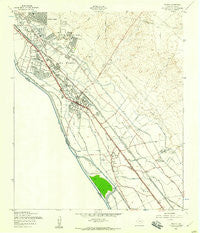
~ Ysleta TX topo map, 1:24000 scale, 7.5 X 7.5 Minute, Historical, 1955, updated 1959
Ysleta, Texas, USGS topographic map dated 1955.
Includes geographic coordinates (latitude and longitude). This topographic map is suitable for hiking, camping, and exploring, or framing it as a wall map.
Printed on-demand using high resolution imagery, on heavy weight and acid free paper, or alternatively on a variety of synthetic materials.
Topos available on paper, Waterproof, Poly, or Tyvek. Usually shipping rolled, unless combined with other folded maps in one order.
- Product Number: USGS-5496791
- Free digital map download (high-resolution, GeoPDF): Ysleta, Texas (file size: 9 MB)
- Map Size: please refer to the dimensions of the GeoPDF map above
- Weight (paper map): ca. 55 grams
- Map Type: POD USGS Topographic Map
- Map Series: HTMC
- Map Verison: Historical
- Cell ID: 50174
- Scan ID: 117328
- Imprint Year: 1959
- Woodland Tint: Yes
- Visual Version Number: 1
- Aerial Photo Year: 1954
- Field Check Year: 1955
- Datum: NAD27
- Map Projection: Polyconic
- Map published by United States Army Corps of Engineers
- Map Language: English
- Scanner Resolution: 600 dpi
- Map Cell Name: Ysleta
- Grid size: 7.5 X 7.5 Minute
- Date on map: 1955
- Map Scale: 1:24000
- Geographical region: Texas, United States
Neighboring Maps:
All neighboring USGS topo maps are available for sale online at a variety of scales.
Spatial coverage:
Topo map Ysleta, Texas, covers the geographical area associated the following places:
- Vinedo Acres Colonia - Corpus Christi de la Isleta (historical) - Ysleta - Mary Lou Park Colonia - San Ysidro Colonia - Tigua - Moon Addition Number 4 Colonia - Spanish Trail Additon Colonia - San Jose - Bovee Road Colonia - Bauman Estates Colonia - Buford View Estates Colonia - Sunhaven Farms Colonia - Moon Addition Number 3 Colonia - Socorro Mission Number 1 Colonia - Lynn Park Replat Colonia - Villa Espana Colonia - Monterosales Colonia - Poole Colonia - Rio Rancho Estates Colonia - Moon Addition Colonia - Ellen Park Colonia - La Junta Addition Colonia - Bagge Estates Colonia - Hillcrest Manor Colonia - Mesa Verde Colonia - Country Green Addition Colonia - Las Milpas Number 2 Colonia - Hacienda Heights - La Jolla Colonia - San Agustin Colonia - Wiseman Estates Colonia - Alameda Estates Colonia - Loma Terrace - McAdoo Acres Colonia - Belen - Gurdev Colonia - Calcutta Colonia - Aldama Estates Colonia - Bauman Estates Number 2 Colonia - North Loop Acres Colonia - Wilton Acres Colonia - Roseville Colonia - Rio Vista Addition Colonia - Socorro Village Addition Colonia - Sunshine Colonia - Moon Addition Number 2 Colonia - Socorro - Belen Plaza Colonia - Algodon Colonia - Delip Colonia - Adobe Colonia - Las Milpas Addition Colonia - Grijalva Gardens Colonia - La Fuente Colonia - Bauman Estates Number 3 Colonia - Buford - Frank Colonia
- Map Area ID: AREA31.7531.625-106.375-106.25
- Northwest corner Lat/Long code: USGSNW31.75-106.375
- Northeast corner Lat/Long code: USGSNE31.75-106.25
- Southwest corner Lat/Long code: USGSSW31.625-106.375
- Southeast corner Lat/Long code: USGSSE31.625-106.25
- Northern map edge Latitude: 31.75
- Southern map edge Latitude: 31.625
- Western map edge Longitude: -106.375
- Eastern map edge Longitude: -106.25


