
~ Wyser Bottom TX topo map, 1:24000 scale, 7.5 X 7.5 Minute, Historical, 1962, updated 1974
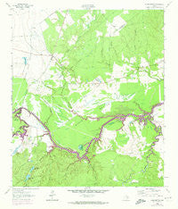
Wyser Bottom, Texas, USGS topographic map dated 1962.
Includes geographic coordinates (latitude and longitude). This topographic map is suitable for hiking, camping, and exploring, or framing it as a wall map.
Printed on-demand using high resolution imagery, on heavy weight and acid free paper, or alternatively on a variety of synthetic materials.
Topos available on paper, Waterproof, Poly, or Tyvek. Usually shipping rolled, unless combined with other folded maps in one order.
- Product Number: USGS-5496711
- Free digital map download (high-resolution, GeoPDF): Wyser Bottom, Texas (file size: 10 MB)
- Map Size: please refer to the dimensions of the GeoPDF map above
- Weight (paper map): ca. 55 grams
- Map Type: POD USGS Topographic Map
- Map Series: HTMC
- Map Verison: Historical
- Cell ID: 49983
- Scan ID: 117291
- Imprint Year: 1974
- Woodland Tint: Yes
- Visual Version Number: 1
- Photo Revision Year: 1972
- Aerial Photo Year: 1972
- Field Check Year: 1962
- Datum: NAD27
- Map Projection: Polyconic
- Map published by United States Geological Survey
- Map Language: English
- Scanner Resolution: 600 dpi
- Map Cell Name: Wyser Bottom
- Grid size: 7.5 X 7.5 Minute
- Date on map: 1962
- Map Scale: 1:24000
- Geographical region: Texas, United States
Neighboring Maps:
All neighboring USGS topo maps are available for sale online at a variety of scales.
Spatial coverage:
Topo map Wyser Bottom, Texas, covers the geographical area associated the following places:
- Lost Indian Lake Dam - Wyser Bottom - Eve Branch - Lost Indian Camp - Cincinnati Bluff - Black Creek - Jenkins Branch - Bedias Creek - East Sulphur Branch - Indian Hill Lake - East Sulphur Branch - Harper Branch - Indian Hill Lake Dam - Moten Lake Dam - White Oak Creek - Little Tucker Lake - Dunlap Cemetery - Bear Branch - Garden Lake Dam - Garden Lake - Wyser Bluff - Lost Indian Lake - Calhoun Ferry (historical) - New Hope Church - Graveyard Creek - Cincinnati Cemetery - Rocky Ford Church - Green Pond - Old Plantation Cemetery (historical) - Waller Lake - Nelson Creek - Horseshoe Lake - Moten Lake - Spivey Cemetery - Calhoun Cemetery - Thompson Branch - Woods Slough - Big Tucker Lake - Black Creek - Melton Branch - Mason Cemetery - White Oak Creek - Mason Slough - Wright Creek - Moten Lake - West Sulphur Branch - Nelson Creek - Polecat Branch
- Map Area ID: AREA3130.875-95.625-95.5
- Northwest corner Lat/Long code: USGSNW31-95.625
- Northeast corner Lat/Long code: USGSNE31-95.5
- Southwest corner Lat/Long code: USGSSW30.875-95.625
- Southeast corner Lat/Long code: USGSSE30.875-95.5
- Northern map edge Latitude: 31
- Southern map edge Latitude: 30.875
- Western map edge Longitude: -95.625
- Eastern map edge Longitude: -95.5


