
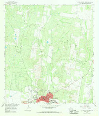
~ Rio Grande City North TX topo map, 1:24000 scale, 7.5 X 7.5 Minute, Historical, 1965, updated 1968
Rio Grande City North, Texas, USGS topographic map dated 1965.
Includes geographic coordinates (latitude and longitude). This topographic map is suitable for hiking, camping, and exploring, or framing it as a wall map.
Printed on-demand using high resolution imagery, on heavy weight and acid free paper, or alternatively on a variety of synthetic materials.
Topos available on paper, Waterproof, Poly, or Tyvek. Usually shipping rolled, unless combined with other folded maps in one order.
- Product Number: USGS-5493011
- Free digital map download (high-resolution, GeoPDF): Rio Grande City North, Texas (file size: 11 MB)
- Map Size: please refer to the dimensions of the GeoPDF map above
- Weight (paper map): ca. 55 grams
- Map Type: POD USGS Topographic Map
- Map Series: HTMC
- Map Verison: Historical
- Cell ID: 37977
- Scan ID: 115163
- Imprint Year: 1968
- Woodland Tint: Yes
- Visual Version Number: 1
- Aerial Photo Year: 1964
- Field Check Year: 1965
- Datum: NAD27
- Map Projection: Polyconic
- Map published by United States Geological Survey
- Map Language: English
- Scanner Resolution: 600 dpi
- Map Cell Name: Rio Grande City North
- Grid size: 7.5 X 7.5 Minute
- Date on map: 1965
- Map Scale: 1:24000
- Geographical region: Texas, United States
Neighboring Maps:
All neighboring USGS topo maps are available for sale online at a variety of scales.
Spatial coverage:
Topo map Rio Grande City North, Texas, covers the geographical area associated the following places:
- La Escondida Colonia - El Mesquite Colonia - Airport Heights Colonia - Francisca Colonia - Garza-Gutierrez Colonia - Rio Grande City - Canales Colonia - Leal Colonia - J L Garcia Colonia - Arredondo Colonia - Triple R Colonia - Salmon Colonia - Live Oak Estates Colonia - La Lomita Colonia - Reyna Colonia - Ranchitos del Norte Colonia - Trevinos Number 1 Colonia - Guerra Colonia - Joseph Griggs Colonia - El Rancho Vela Colonia - Mitchell Colonia - Loma Alta Colonia - Olivarez Colonia - Trevinos Colonia - Garcia's Colonia - Cortez Colonia - San Fernando Colonia - A T Martinez Colonia - Bella Vista Colonia - Los Olmos Colonia - Valle Hermosa Colonia - Sammy Martinez Colonia - Triple R Number 1 Colonia - Doyno West Side Number 2 Colonia - San Jose Colonia
- Map Area ID: AREA26.526.375-98.875-98.75
- Northwest corner Lat/Long code: USGSNW26.5-98.875
- Northeast corner Lat/Long code: USGSNE26.5-98.75
- Southwest corner Lat/Long code: USGSSW26.375-98.875
- Southeast corner Lat/Long code: USGSSE26.375-98.75
- Northern map edge Latitude: 26.5
- Southern map edge Latitude: 26.375
- Western map edge Longitude: -98.875
- Eastern map edge Longitude: -98.75


