
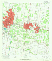
~ Pharr TX topo map, 1:24000 scale, 7.5 X 7.5 Minute, Historical, 1963, updated 1965
Pharr, Texas, USGS topographic map dated 1963.
Includes geographic coordinates (latitude and longitude). This topographic map is suitable for hiking, camping, and exploring, or framing it as a wall map.
Printed on-demand using high resolution imagery, on heavy weight and acid free paper, or alternatively on a variety of synthetic materials.
Topos available on paper, Waterproof, Poly, or Tyvek. Usually shipping rolled, unless combined with other folded maps in one order.
- Product Number: USGS-5492105
- Free digital map download (high-resolution, GeoPDF): Pharr, Texas (file size: 9 MB)
- Map Size: please refer to the dimensions of the GeoPDF map above
- Weight (paper map): ca. 55 grams
- Map Type: POD USGS Topographic Map
- Map Series: HTMC
- Map Verison: Historical
- Cell ID: 34935
- Scan ID: 114939
- Imprint Year: 1965
- Woodland Tint: Yes
- Visual Version Number: 1
- Aerial Photo Year: 1961
- Survey Year: 1963
- Datum: NAD27
- Map Projection: Polyconic
- Map published by United States Geological Survey
- Map Language: English
- Scanner Resolution: 600 dpi
- Map Cell Name: Pharr
- Grid size: 7.5 X 7.5 Minute
- Date on map: 1963
- Map Scale: 1:24000
- Geographical region: Texas, United States
Neighboring Maps:
All neighboring USGS topo maps are available for sale online at a variety of scales.
Spatial coverage:
Topo map Pharr, Texas, covers the geographical area associated the following places:
- Milagro Estates Colonia - El Charro Colonia - Romo Colonia - Gonzalez-Zamora Colonia - Porciones Center Colonia - Yvonne Colonia - Arguello Colonia - Primavera Colonia Number 1 - San Juan - Universal Estates Colonia - Lantana Colonia - Minnesota Road-I Road Colonia - Citriana Village Colonia - Bryan's Addition Colonia - Eldora Gardens Colonia - North Alamo - Paradise Park Colonia - Citrus Ranchitos Colonia - Whalen Acres Colonia - R S W incorporated Number 1 Colonia - Beamsley Colonia - San Juan South Estates Colonia - McAllen - Primavera Number 2 Colonia - Lopezville - Arguello Number 2 Colonia - Sun Valley Estates Number 1 Colonia - Country Living Estates Colonia - La Quinta Colonia - Colonia Evans Number 2 - Val Bar Estate Colonia - Villa del Sol Colonia - Arco Iris Number 2 Colonia - Starr Colonia - Rodriguez Street Colonia - Pharr - Miller Resub Lot A Colonia - Morningsun Colonia - Morningside Mobile Home Park Colonia - Eldora Rd-FM 1426 Colonia - Palm Heights Colonia - FM 1426-Minnesota Road Colonia - Sioux Terrace Colonia - Owassa-I Rd Colonia - Valley Star Acres Colonia - El Sol Colonia - Alamo Orchards Colonia - Azteca Acres Colonia - San Juan East Colonia - Sings Colonia - Eldora Colonia - Casa Bonita Colonia - Las Palmas Estates Colonia - Owassa-Kennedy Colonia - Country Living Estates Number 2 Colonia - Thrasher Terrace Colonia - North Depot Road Colonia - L R Bell Colonia - Encino Heights Colonia - Ridge Road Colonia - Robinette Colonia - Bar Number 4 Colonia - Tagle Colonia Number 1 - Francis Addition Colonia - Moore Road Colonia - Campo Alto - Plumosa Village Colonia - Williams Colonia - Sioux Terrace South Colonia - Gomez Colonia - Barrios Number 2 Colonia - Colonia Evans - Tiny Acres Colonia - Rancho Escondido Colonia - Diaz Colonia - McDaniel Colonia - Evie Colonia - HME Colonia - Red Barn Colonia - Border Colonia - Moore Road Colonia - Alberta Estates Number 2 Colonia
- Map Area ID: AREA26.2526.125-98.25-98.125
- Northwest corner Lat/Long code: USGSNW26.25-98.25
- Northeast corner Lat/Long code: USGSNE26.25-98.125
- Southwest corner Lat/Long code: USGSSW26.125-98.25
- Southeast corner Lat/Long code: USGSSE26.125-98.125
- Northern map edge Latitude: 26.25
- Southern map edge Latitude: 26.125
- Western map edge Longitude: -98.25
- Eastern map edge Longitude: -98.125


