
~ Fortress Cliff TX topo map, 1:24000 scale, 7.5 X 7.5 Minute, Historical, 1956, updated 1978
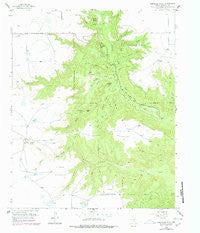
Fortress Cliff, Texas, USGS topographic map dated 1956.
Includes geographic coordinates (latitude and longitude). This topographic map is suitable for hiking, camping, and exploring, or framing it as a wall map.
Printed on-demand using high resolution imagery, on heavy weight and acid free paper, or alternatively on a variety of synthetic materials.
Topos available on paper, Waterproof, Poly, or Tyvek. Usually shipping rolled, unless combined with other folded maps in one order.
- Product Number: USGS-5486251
- Free digital map download (high-resolution, GeoPDF): Fortress Cliff, Texas (file size: 10 MB)
- Map Size: please refer to the dimensions of the GeoPDF map above
- Weight (paper map): ca. 55 grams
- Map Type: POD USGS Topographic Map
- Map Series: HTMC
- Map Verison: Historical
- Cell ID: 16041
- Scan ID: 108263
- Imprint Year: 1978
- Woodland Tint: Yes
- Visual Version Number: 2
- Photo Revision Year: 1977
- Aerial Photo Year: 1976
- Edit Year: 1977
- Survey Year: 1956
- Datum: NAD27
- Map Projection: Polyconic
- Map published by United States Geological Survey
- Map Language: English
- Scanner Resolution: 600 dpi
- Map Cell Name: Fortress Cliff
- Grid size: 7.5 X 7.5 Minute
- Date on map: 1956
- Map Scale: 1:24000
- Geographical region: Texas, United States
Neighboring Maps:
All neighboring USGS topo maps are available for sale online at a variety of scales.
Spatial coverage:
Topo map Fortress Cliff, Texas, covers the geographical area associated the following places:
- Brushy Draw - South Brushy Draw - Judys Arch - South Cita Canyon - Fortress Cliff - Palo Duro Canyon State Park Trail - Red Mesa - Red Canyon - Cooley Butte - Lighthouse Peak - Little Sunday Creek - Timber Creek - North Cita Creek - Mesquite Park - Corral Draw - Timber Mesa - Tub Springs Draw - Bull Draw - Reynolds Ranch - Capitol Peak Canyon - Castle Peak - Capitol Mesa - North Spur Valley - Tub Springs - Cooley Draw - Long Draw - Capitol Peak - Rustlers Draw - North Cita Canyon - Elbow Plateau - Devils Tombstone - Burnt Draw - Swan Plateau - South Cita Creek - Seep Canyon - Woody Draw - Sunday Flats - Palo Duro State Park - Goodnight Peak - Brushy Butte - Sunday Creek - Krahn Ranch - Pin Draw
- Map Area ID: AREA3534.875-101.75-101.625
- Northwest corner Lat/Long code: USGSNW35-101.75
- Northeast corner Lat/Long code: USGSNE35-101.625
- Southwest corner Lat/Long code: USGSSW34.875-101.75
- Southeast corner Lat/Long code: USGSSE34.875-101.625
- Northern map edge Latitude: 35
- Southern map edge Latitude: 34.875
- Western map edge Longitude: -101.75
- Eastern map edge Longitude: -101.625


