
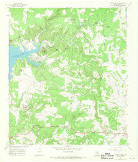
~ Council Creek TX topo map, 1:24000 scale, 7.5 X 7.5 Minute, Historical, 1967, updated 1970
Council Creek, Texas, USGS topographic map dated 1967.
Includes geographic coordinates (latitude and longitude). This topographic map is suitable for hiking, camping, and exploring, or framing it as a wall map.
Printed on-demand using high resolution imagery, on heavy weight and acid free paper, or alternatively on a variety of synthetic materials.
Topos available on paper, Waterproof, Poly, or Tyvek. Usually shipping rolled, unless combined with other folded maps in one order.
- Product Number: USGS-5484429
- Free digital map download (high-resolution, GeoPDF): Council Creek, Texas (file size: 10 MB)
- Map Size: please refer to the dimensions of the GeoPDF map above
- Weight (paper map): ca. 55 grams
- Map Type: POD USGS Topographic Map
- Map Series: HTMC
- Map Verison: Historical
- Cell ID: 10352
- Scan ID: 108884
- Imprint Year: 1970
- Woodland Tint: Yes
- Visual Version Number: 0
- Aerial Photo Year: 1966
- Field Check Year: 1967
- Datum: NAD27
- Map Projection: Polyconic
- Map published by United States Geological Survey
- Map Language: English
- Scanner Resolution: 600 dpi
- Map Cell Name: Council Creek
- Grid size: 7.5 X 7.5 Minute
- Date on map: 1967
- Map Scale: 1:24000
- Geographical region: Texas, United States
Neighboring Maps:
All neighboring USGS topo maps are available for sale online at a variety of scales.
Spatial coverage:
Topo map Council Creek, Texas, covers the geographical area associated the following places:
- Rough Hollow - Wolf Hollow - Adams Creek - Spider Mountain - McCoy Hollow - Post Mountain Cemetery - Mill Hollow - Council Creek - Pal Spring - Cherry Spring - South Fork Morgan Creek - Burnet Division - Boiling Springs - Cedar Mountain - Lion Mountain - Jahn Cemetery - Trough Spring - Potato Hill - Dog Hollow - Fry Branch - Fourmile Spring - Johhny Branch - Johhny Grave Mountain - KGZG-FM (Burnet) - Mud Springs - Rocky Hollow - Fisher - Fry Cemetery - Brown Cemetery - Pebble Mound Cemetery - Rock Hollow - Robins Gap - Simms Spring - North Fork Morgan Creek - Hickey Branch - Fry Cemetery - Green Mountain - Buzzard Hollow - Shale Valley Ranch Airport - Dublin Public Library
- Map Area ID: AREA30.87530.75-98.375-98.25
- Northwest corner Lat/Long code: USGSNW30.875-98.375
- Northeast corner Lat/Long code: USGSNE30.875-98.25
- Southwest corner Lat/Long code: USGSSW30.75-98.375
- Southeast corner Lat/Long code: USGSSE30.75-98.25
- Northern map edge Latitude: 30.875
- Southern map edge Latitude: 30.75
- Western map edge Longitude: -98.375
- Eastern map edge Longitude: -98.25


