
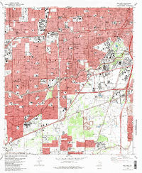
~ Bellaire TX topo map, 1:24000 scale, 7.5 X 7.5 Minute, Historical, 1982, updated 1983
Bellaire, Texas, USGS topographic map dated 1982.
Includes geographic coordinates (latitude and longitude). This topographic map is suitable for hiking, camping, and exploring, or framing it as a wall map.
Printed on-demand using high resolution imagery, on heavy weight and acid free paper, or alternatively on a variety of synthetic materials.
Topos available on paper, Waterproof, Poly, or Tyvek. Usually shipping rolled, unless combined with other folded maps in one order.
- Product Number: USGS-5482259
- Free digital map download (high-resolution, GeoPDF): Bellaire, Texas (file size: 18 MB)
- Map Size: please refer to the dimensions of the GeoPDF map above
- Weight (paper map): ca. 55 grams
- Map Type: POD USGS Topographic Map
- Map Series: HTMC
- Map Verison: Historical
- Cell ID: 3151
- Scan ID: 105832
- Imprint Year: 1983
- Woodland Tint: Yes
- Visual Version Number: 1
- Aerial Photo Year: 1976
- Edit Year: 1982
- Field Check Year: 1976
- Datum: NAD27
- Map Projection: Lambert Conformal Conic
- Map published by United States Geological Survey
- Map Language: English
- Scanner Resolution: 600 dpi
- Map Cell Name: Bellaire
- Grid size: 7.5 X 7.5 Minute
- Date on map: 1982
- Map Scale: 1:24000
- Geographical region: Texas, United States
Neighboring Maps:
All neighboring USGS topo maps are available for sale online at a variety of scales.
Spatial coverage:
Topo map Bellaire, Texas, covers the geographical area associated the following places:
- Alrion - Cambridge Village - Bellaire Junction - Barkley Circle - Heatherwood - Westwood - Maplewood North - Reedwoods - Westbury South - Meyerland - Westwood Park - Southampton Place - Glen Iris - Blueridge - Almeda Plaza - Southside Place - Willow Brook - Braeswood - Myrtle - Pamela Heights - Briargrove - West University Place - Bellaire - Maplewood - Linkwood - Heakers - Lamar Terrace - Woodside Plaza - Southwest Manor - Westbury - Bentwood West - Barkley Square South - Heaker - Post Oak Manor - Pierce Junction - Woodside - Willow Bend - Parkwest
- Map Area ID: AREA29.7529.625-95.5-95.375
- Northwest corner Lat/Long code: USGSNW29.75-95.5
- Northeast corner Lat/Long code: USGSNE29.75-95.375
- Southwest corner Lat/Long code: USGSSW29.625-95.5
- Southeast corner Lat/Long code: USGSSE29.625-95.375
- Northern map edge Latitude: 29.75
- Southern map edge Latitude: 29.625
- Western map edge Longitude: -95.5
- Eastern map edge Longitude: -95.375


