
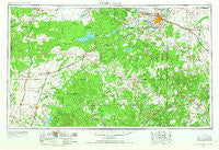
~ Wichita Falls TX topo map, 1:250000 scale, 1 X 2 Degree, Historical, 1954, updated 1966
Wichita Falls, Texas, USGS topographic map dated 1954.
Includes geographic coordinates (latitude and longitude). This topographic map is suitable for hiking, camping, and exploring, or framing it as a wall map.
Printed on-demand using high resolution imagery, on heavy weight and acid free paper, or alternatively on a variety of synthetic materials.
Topos available on paper, Waterproof, Poly, or Tyvek. Usually shipping rolled, unless combined with other folded maps in one order.
- Product Number: USGS-5481203
- Free digital map download (high-resolution, GeoPDF): Wichita Falls, Texas (file size: 15 MB)
- Map Size: please refer to the dimensions of the GeoPDF map above
- Weight (paper map): ca. 55 grams
- Map Type: POD USGS Topographic Map
- Map Series: HTMC
- Map Verison: Historical
- Cell ID: 69098
- Scan ID: 117118
- Imprint Year: 1966
- Woodland Tint: Yes
- Visual Version Number: 0
- Aerial Photo Year: 1953
- Edit Year: 1965
- Field Check Year: 1954
- Datum: Unstated
- Map Projection: Transverse Mercator
- Map published by United States Geological Survey
- Map Language: English
- Scanner Resolution: 600 dpi
- Map Cell Name: Wichita Falls
- Grid size: 1 X 2 Degree
- Date on map: 1954
- Map Scale: 1:250000
- Geographical region: Texas, United States
Neighboring Maps:
All neighboring USGS topo maps are available for sale online at a variety of scales.
Spatial coverage:
Topo map Wichita Falls, Texas, covers the geographical area associated the following places:
- O'Brien - Ogden - Bartons Chapel - Spring Creek - Bryson - Jermyn - Jud - Rochester - Newcastle - Fulda - Paint Crossing - Bunger - Weinert - Black Flat - Kamay - Rule - Senate - True - Bacon - Pleasant Valley - Twin Mountains - Plainview - Bomarton - Edwards - Dundee - Allendale - Markley - Woodson - Proffitt Crossing - Truce - Thalia - Valley View - Jud - Bluegrove - Graham - Dean - Mattson - Hartex - Perrin - Westover - Windthorst - Mabelle - Goree - Hoot and Holler Crossing - Sagerton - Gentry Crossing - Foard City - Coody Crossing - Raymond - Kadane Corner - Vera - Oakland - Megargel - Prospect - Wichita Falls - Knox City - Jean - Round Timber - Elbert - Seymour - Jacksboro - McKeichan Crossing - Reynolds Crossing - Walton - Munday - Haskell - Dads Corner - Scott Crossing - Archer City - Shannon - Irby - Buffalo Springs - Old Caseyville Crossing - Olney - Mankins - Anarene - Belknap (historical) - Scotland - Red Top - Henrietta - Bellevue - Antelope - Benjamin - Vashti - Bartholomew Crossing - Padgett - Midway Crossing - Rhineland - Sunset - Dug Ford - Josselet - Iowa Park - Holliday - Rock Crossing - Throckmorton - Paint Creek - Squaw Mountain - M K Crossing - Postoak - Huggins
- Map Area ID: AREA3433-100-98
- Northwest corner Lat/Long code: USGSNW34-100
- Northeast corner Lat/Long code: USGSNE34-98
- Southwest corner Lat/Long code: USGSSW33-100
- Southeast corner Lat/Long code: USGSSE33-98
- Northern map edge Latitude: 34
- Southern map edge Latitude: 33
- Western map edge Longitude: -100
- Eastern map edge Longitude: -98


