
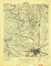
~ Waco TX topo map, 1:125000 scale, 30 X 30 Minute, Historical, 1920
Waco, Texas, USGS topographic map dated 1920.
Includes geographic coordinates (latitude and longitude). This topographic map is suitable for hiking, camping, and exploring, or framing it as a wall map.
Printed on-demand using high resolution imagery, on heavy weight and acid free paper, or alternatively on a variety of synthetic materials.
Topos available on paper, Waterproof, Poly, or Tyvek. Usually shipping rolled, unless combined with other folded maps in one order.
- Product Number: USGS-5480849
- Free digital map download (high-resolution, GeoPDF): Waco, Texas (file size: 8 MB)
- Map Size: please refer to the dimensions of the GeoPDF map above
- Weight (paper map): ca. 55 grams
- Map Type: POD USGS Topographic Map
- Map Series: HTMC
- Map Verison: Historical
- Cell ID: 66866
- Scan ID: 137573
- Visual Version Number: 1
- Datum: Unstated
- Map Projection: Unstated
- Advance: Yes
- Map published by United States Army Corps of Engineers
- Keywords: Nonstandard Press Run
- Map Language: English
- Scanner Resolution: 600 dpi
- Map Cell Name: Waco
- Grid size: 30 X 30 Minute
- Date on map: 1920
- Map Scale: 1:125000
- Geographical region: Texas, United States
Neighboring Maps:
All neighboring USGS topo maps are available for sale online at a variety of scales.
Spatial coverage:
Topo map Waco, Texas, covers the geographical area associated the following places:
- Bynum - Chatt - Wardlaw - Erath - Lakewood Harbor - Greenock - Bosqueville - Woodway - Bellmead - Aquilla - Tyson - Wiggins - Waco - Vemo - Ross - Rogers Hill - Bannas Junction - Crawford - Jewell - Highland - Laguna Park - Beverly - Neale - Womack - Northcrest - Rock Creek - Winslow - Woodland Hills - Eichelberger Crossing - Tours - Gholson - Oaklake - Prairie Valley - Speegleville - Ocaw - Valley View - Elm Mott - Peoria - Abbott - Windsor - Vaughan - Willow Grove - West - Tokio - Rock Springs - Whitney - Lebanon - Valley Mills - East Waco - Lacy-Lakeview - Caldwell Crossing - Spivey Crossing - Menlow - Cottonwood - Cayote - Smiths Bend - Cedar Shores - Patrick - Ocee - Beverly Hills - Leroy - China Springs
- Map Area ID: AREA3231.5-97.5-97
- Northwest corner Lat/Long code: USGSNW32-97.5
- Northeast corner Lat/Long code: USGSNE32-97
- Southwest corner Lat/Long code: USGSSW31.5-97.5
- Southeast corner Lat/Long code: USGSSE31.5-97
- Northern map edge Latitude: 32
- Southern map edge Latitude: 31.5
- Western map edge Longitude: -97.5
- Eastern map edge Longitude: -97


