
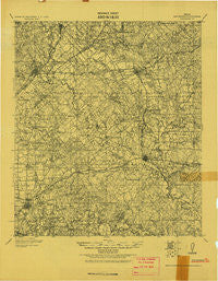
~ San Marcos TX topo map, 1:125000 scale, 30 X 30 Minute, Historical, 1919
San Marcos, Texas, USGS topographic map dated 1919.
Includes geographic coordinates (latitude and longitude). This topographic map is suitable for hiking, camping, and exploring, or framing it as a wall map.
Printed on-demand using high resolution imagery, on heavy weight and acid free paper, or alternatively on a variety of synthetic materials.
Topos available on paper, Waterproof, Poly, or Tyvek. Usually shipping rolled, unless combined with other folded maps in one order.
- Product Number: USGS-5480703
- Free digital map download (high-resolution, GeoPDF): San Marcos, Texas (file size: 10 MB)
- Map Size: please refer to the dimensions of the GeoPDF map above
- Weight (paper map): ca. 55 grams
- Map Type: POD USGS Topographic Map
- Map Series: HTMC
- Map Verison: Historical
- Cell ID: 66549
- Scan ID: 128641
- Visual Version Number: 1
- Datum: Unstated
- Map Projection: Unstated
- Map published by United States Army Corps of Engineers
- Keywords: Nonstandard Press Run
- Map Language: English
- Scanner Resolution: 600 dpi
- Map Cell Name: San Marcos
- Grid size: 30 X 30 Minute
- Date on map: 1919
- Map Scale: 1:125000
- Geographical region: Texas, United States
Neighboring Maps:
All neighboring USGS topo maps are available for sale online at a variety of scales.
Spatial coverage:
Topo map San Marcos, Texas, covers the geographical area associated the following places:
- Martindale - Belmont - Prairie Lea - Lockhart - San Marcos - Harwood - Stairtown - Smithville - Maxwell - Mineral Springs (historical) - Brownsboro - Tilmon - Reedville - Luling - Seawillow - Joliet - Dale - Redwood - Dugger - Galle - Kingsbury - McNeil - Centex - Lauback - Weinert - Watts - Staples - Kyle - Soda Springs - Ottine - Saint Johns Colony - Saint James - Zorn - Fentress - McMahan - Slayden - Uhland - Seguin - Geronimo
- Map Area ID: AREA3029.5-98-97.5
- Northwest corner Lat/Long code: USGSNW30-98
- Northeast corner Lat/Long code: USGSNE30-97.5
- Southwest corner Lat/Long code: USGSSW29.5-98
- Southeast corner Lat/Long code: USGSSE29.5-97.5
- Northern map edge Latitude: 30
- Southern map edge Latitude: 29.5
- Western map edge Longitude: -98
- Eastern map edge Longitude: -97.5


