
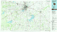
~ Wichita Falls TX topo map, 1:100000 scale, 30 X 60 Minute, Historical, 1985, updated 1985
Wichita Falls, Texas, USGS topographic map dated 1985.
Includes geographic coordinates (latitude and longitude). This topographic map is suitable for hiking, camping, and exploring, or framing it as a wall map.
Printed on-demand using high resolution imagery, on heavy weight and acid free paper, or alternatively on a variety of synthetic materials.
Topos available on paper, Waterproof, Poly, or Tyvek. Usually shipping rolled, unless combined with other folded maps in one order.
- Product Number: USGS-5480207
- Free digital map download (high-resolution, GeoPDF): Wichita Falls, Texas (file size: 21 MB)
- Map Size: please refer to the dimensions of the GeoPDF map above
- Weight (paper map): ca. 55 grams
- Map Type: POD USGS Topographic Map
- Map Series: HTMC
- Map Verison: Historical
- Cell ID: 68587
- Scan ID: 123634
- Imprint Year: 1985
- Woodland Tint: Yes
- Visual Version Number: 1
- Aerial Photo Year: 1983
- Edit Year: 1985
- Datum: NAD27
- Map Projection: Universal Transverse Mercator
- Planimetric: Yes
- Map published by United States Geological Survey
- Map Language: English
- Scanner Resolution: 600 dpi
- Map Cell Name: Wichita Falls
- Grid size: 30 X 60 Minute
- Date on map: 1985
- Map Scale: 1:100000
- Geographical region: Texas, United States
Neighboring Maps:
All neighboring USGS topo maps are available for sale online at a variety of scales.
Spatial coverage:
Topo map Wichita Falls, Texas, covers the geographical area associated the following places:
- Pleasant Valley - Edwards - Allendale - Valley View - Lakeside City - Holliday - Vashti - Joy - Kadane Corner - Bellevue - Archer City - Raymond - Henrietta - Dickworsham - Bluegrove - Dads Corner - Fowlkes - Huggins - Walton - Bacon - Deer Creek - Dean - Kamay - Windthorst - Jolly - Frame - Hartex - Luke Wilson - Wichita Falls - Black Flat - Scotland - Dundee - Iowa Park - Mankins - Buffalo Springs - Halsell - Hurnville
- Map Area ID: AREA3433.5-99-98
- Northwest corner Lat/Long code: USGSNW34-99
- Northeast corner Lat/Long code: USGSNE34-98
- Southwest corner Lat/Long code: USGSSW33.5-99
- Southeast corner Lat/Long code: USGSSE33.5-98
- Northern map edge Latitude: 34
- Southern map edge Latitude: 33.5
- Western map edge Longitude: -99
- Eastern map edge Longitude: -98


