
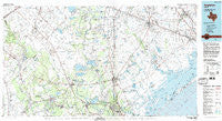
~ Angleton TX topo map, 1:100000 scale, 30 X 60 Minute, Historical, 1984, updated 1984
Angleton, Texas, USGS topographic map dated 1984.
Includes geographic coordinates (latitude and longitude). This topographic map is suitable for hiking, camping, and exploring, or framing it as a wall map.
Printed on-demand using high resolution imagery, on heavy weight and acid free paper, or alternatively on a variety of synthetic materials.
Topos available on paper, Waterproof, Poly, or Tyvek. Usually shipping rolled, unless combined with other folded maps in one order.
- Product Number: USGS-5479691
- Free digital map download (high-resolution, GeoPDF): Angleton, Texas (file size: 22 MB)
- Map Size: please refer to the dimensions of the GeoPDF map above
- Weight (paper map): ca. 55 grams
- Map Type: POD USGS Topographic Map
- Map Series: HTMC
- Map Verison: Historical
- Cell ID: 67053
- Scan ID: 108167
- Imprint Year: 1984
- Woodland Tint: Yes
- Visual Version Number: 0
- Aerial Photo Year: 1979
- Edit Year: 1984
- Datum: NAD27
- Map Projection: Universal Transverse Mercator
- Map published by United States Geological Survey
- Map Language: English
- Scanner Resolution: 600 dpi
- Map Cell Name: Angleton
- Grid size: 30 X 60 Minute
- Date on map: 1984
- Map Scale: 1:100000
- Geographical region: Texas, United States
Neighboring Maps:
All neighboring USGS topo maps are available for sale online at a variety of scales.
Spatial coverage:
Topo map Angleton, Texas, covers the geographical area associated the following places:
- Pledger - Don-Tol - Sienna Plantation - Pleak - Oaks of Clear Creek - Hitchcock - Snipe - Ross - Newgulf Junction - Abercrombie - Port Morris - Bailey Prairie - Carmel Village - Sandy Point - Richwood - Long Point - Falcon Ridge - Alvin - Mims - Algoa - Podo - Lochridge - Boling - Chocolate Springs - English - Juliff - Santa Fe - Rosharon - Arcadia - Chocolate Bayou - Newgulf - Terramar Beach - Danciger - Ashwood - Hoskins - Mission Estates - Lake Jackson Farms - Bay Harbor - Mooredale - Orozimbo - Crescent Ranch Estates - Windsong - Red Fish Cove - Chenango - Rancho Viejo - Manvel - Bastrop Beach - Otey - Bonney - Van Pelt - Four Corners - Peterson Landing - East Columbia - McCroskey - Century Oaks Estates - Hawdon - Eagle Lakes - Iowa Colony - Lake Jackson - Iago - Dickinson - El Bernardo - Van Vleck - Arcola - Sea Isle - Old Brazoria - Damon - Thompsons - Sun Meadow - Beasley - Brazoria - Hillcrest - West Columbia - Hasima - San Joaquin Estates - Fairchilds - El Dorado - Windsor Estates - Old Ocean - Magnet - Sugar Valley - Liverpool - Chalmers - Whaley Corner - Guy - Danbury - Kendleton - Clute - Oyster Creek - Cane Junction - Lake Barbara - Holiday Lakes - Allenhurst - Anchor - Wild Peach - China Grove - Needville - Wild Peach Village - Angleton - Brittany Bay
- Map Area ID: AREA29.529-96-95
- Northwest corner Lat/Long code: USGSNW29.5-96
- Northeast corner Lat/Long code: USGSNE29.5-95
- Southwest corner Lat/Long code: USGSSW29-96
- Southeast corner Lat/Long code: USGSSE29-95
- Northern map edge Latitude: 29.5
- Southern map edge Latitude: 29
- Western map edge Longitude: -96
- Eastern map edge Longitude: -95


