
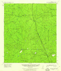
~ Velenzuela Creek TX topo map, 1:62500 scale, 15 X 15 Minute, Historical, 1940, updated 1984
Velenzuela Creek, Texas, USGS topographic map dated 1940.
Includes geographic coordinates (latitude and longitude). This topographic map is suitable for hiking, camping, and exploring, or framing it as a wall map.
Printed on-demand using high resolution imagery, on heavy weight and acid free paper, or alternatively on a variety of synthetic materials.
Topos available on paper, Waterproof, Poly, or Tyvek. Usually shipping rolled, unless combined with other folded maps in one order.
- Product Number: USGS-5479537
- Free digital map download (high-resolution, GeoPDF): Velenzuela Creek, Texas (file size: 7 MB)
- Map Size: please refer to the dimensions of the GeoPDF map above
- Weight (paper map): ca. 55 grams
- Map Type: POD USGS Topographic Map
- Map Series: HTMC
- Map Verison: Historical
- Cell ID: 64061
- Scan ID: 116881
- Imprint Year: 1984
- Woodland Tint: Yes
- Aerial Photo Year: 1940
- Field Check Year: 1940
- Datum: NAD27
- Map Projection: Polyconic
- Map published by United States Geological Survey
- Map published by United States Army Corps of Engineers
- Map Language: English
- Scanner Resolution: 600 dpi
- Map Cell Name: Velenzuela Creek
- Grid size: 15 X 15 Minute
- Date on map: 1940
- Map Scale: 1:62500
- Geographical region: Texas, United States
Neighboring Maps:
All neighboring USGS topo maps are available for sale online at a variety of scales.
Spatial coverage:
Topo map Velenzuela Creek, Texas, covers the geographical area associated the following places:
- Velenzuela Ranch - C Chenault - Galvan Ranch - Buena Vista Ranch - Cuchara Creek - Harrison Lake Number 3 Dam - Valenzuela Ranch Headquarters - Brewster Ranch - United States Border Patrol Checkpoint - Bennet Ranch - Espejo - Gates Lake Number 2 - S Cotulla - Strait Ranch Airport - Harrison Piloncillo Ranch Airport - A Schletze - Chalker Creek - Harrison Lake Number 1 Dam - G Lyles - Milstead Lake Dam - Gates Lake Number 2 Dam - Tiller Lake Dam - Tierra Blanca Creek - Milstead Lake - Snakel Ranch - Harrison Lake Number 3 - Hill Top Inn - Tiller Lake - Harrison Lake Number 1 - Canyon Creek - Harrison Lake Number 2 Dam - La Esperanza Ranch Airport - Pelon Ciz Ranch - Harrison Lake Number 2
- Map Area ID: AREA28.2528-99.75-99.5
- Northwest corner Lat/Long code: USGSNW28.25-99.75
- Northeast corner Lat/Long code: USGSNE28.25-99.5
- Southwest corner Lat/Long code: USGSSW28-99.75
- Southeast corner Lat/Long code: USGSSE28-99.5
- Northern map edge Latitude: 28.25
- Southern map edge Latitude: 28
- Western map edge Longitude: -99.75
- Eastern map edge Longitude: -99.5


