
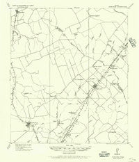
~ Dime Box TX topo map, 1:62500 scale, 15 X 15 Minute, Historical, 1919, updated 1956
Dime Box, Texas, USGS topographic map dated 1919.
Includes geographic coordinates (latitude and longitude). This topographic map is suitable for hiking, camping, and exploring, or framing it as a wall map.
Printed on-demand using high resolution imagery, on heavy weight and acid free paper, or alternatively on a variety of synthetic materials.
Topos available on paper, Waterproof, Poly, or Tyvek. Usually shipping rolled, unless combined with other folded maps in one order.
- Product Number: USGS-5478355
- Free digital map download (high-resolution, GeoPDF): Dime Box, Texas (file size: 4 MB)
- Map Size: please refer to the dimensions of the GeoPDF map above
- Weight (paper map): ca. 55 grams
- Map Type: POD USGS Topographic Map
- Map Series: HTMC
- Map Verison: Historical
- Cell ID: 53445
- Scan ID: 107485
- Imprint Year: 1956
- Visual Version Number: 1
- Datum: Unstated
- Map Projection: Unstated
- Map published by United States Army Corps of Engineers
- Keywords: Nonstandard Press Run
- Map Language: English
- Scanner Resolution: 600 dpi
- Map Cell Name: Dime Box
- Grid size: 15 X 15 Minute
- Date on map: 1919
- Map Scale: 1:62500
- Geographical region: Texas, United States
Neighboring Maps:
All neighboring USGS topo maps are available for sale online at a variety of scales.
Spatial coverage:
Topo map Dime Box, Texas, covers the geographical area associated the following places:
- Sweet Home - Hogg - Deanville - Old Dime Box - Gus - Tanglewood - Dime Box - Doak Springs - San Antonio Prairie - Lincoln - Leo - Loebau
- Map Area ID: AREA30.530.25-97-96.75
- Northwest corner Lat/Long code: USGSNW30.5-97
- Northeast corner Lat/Long code: USGSNE30.5-96.75
- Southwest corner Lat/Long code: USGSSW30.25-97
- Southeast corner Lat/Long code: USGSSE30.25-96.75
- Northern map edge Latitude: 30.5
- Southern map edge Latitude: 30.25
- Western map edge Longitude: -97
- Eastern map edge Longitude: -96.75


