
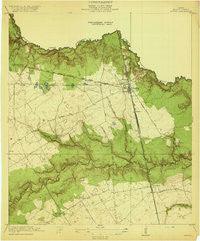
~ Spring TX topo map, 1:31680 scale, 7.5 X 7.5 Minute, Historical, 1920
Spring, Texas, USGS topographic map dated 1920.
Includes geographic coordinates (latitude and longitude). This topographic map is suitable for hiking, camping, and exploring, or framing it as a wall map.
Printed on-demand using high resolution imagery, on heavy weight and acid free paper, or alternatively on a variety of synthetic materials.
Topos available on paper, Waterproof, Poly, or Tyvek. Usually shipping rolled, unless combined with other folded maps in one order.
- Product Number: USGS-5477897
- Free digital map download (high-resolution, GeoPDF): Spring, Texas (file size: 7 MB)
- Map Size: please refer to the dimensions of the GeoPDF map above
- Weight (paper map): ca. 55 grams
- Map Type: POD USGS Topographic Map
- Map Series: HTMC
- Map Verison: Historical
- Cell ID: 42579
- Scan ID: 128304
- Woodland Tint: Yes
- Visual Version Number: 1
- Survey Year: 1916
- Datum: Unstated
- Map Projection: Unstated
- Preliminary map: Yes
- Map published by United States Geological Survey
- Map Language: English
- Scanner Resolution: 600 dpi
- Map Cell Name: Spring
- Grid size: 7.5 X 7.5 Minute
- Date on map: 1920
- Map Scale: 1:31680
- Geographical region: Texas, United States
Neighboring Maps:
All neighboring USGS topo maps are available for sale online at a variety of scales.
Spatial coverage:
Topo map Spring, Texas, covers the geographical area associated the following places:
- Rotherwood - Ponderosa Forest - Olde Oaks - Forest North - Bammel - Northview - Spring Hills - Bammel Timbers - Cypresswood Court - Cypresswood - Spring - Windsor Forest - Cypress Villas - Terranova - Chantilly Woods - North Forest - Fox Hollow - Northridge Park - Northland Shopping Center - Westfield - Lexington Woods - Bridgestone Ranch - Bammel Forest - Timber Lane - Northgate Crossing - Oak Creek Village - Cypresswood Glen - Candlelight Hills - Oaks of Devonshire - Spring Lakes
- Map Area ID: AREA30.12530-95.5-95.375
- Northwest corner Lat/Long code: USGSNW30.125-95.5
- Northeast corner Lat/Long code: USGSNE30.125-95.375
- Southwest corner Lat/Long code: USGSSW30-95.5
- Southeast corner Lat/Long code: USGSSE30-95.375
- Northern map edge Latitude: 30.125
- Southern map edge Latitude: 30
- Western map edge Longitude: -95.5
- Eastern map edge Longitude: -95.375


