
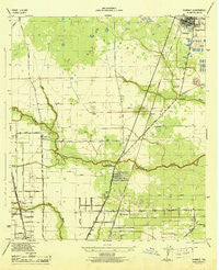
~ Humble TX topo map, 1:31680 scale, 7.5 X 7.5 Minute, Historical, 1946
Humble, Texas, USGS topographic map dated 1946.
Includes geographic coordinates (latitude and longitude). This topographic map is suitable for hiking, camping, and exploring, or framing it as a wall map.
Printed on-demand using high resolution imagery, on heavy weight and acid free paper, or alternatively on a variety of synthetic materials.
Topos available on paper, Waterproof, Poly, or Tyvek. Usually shipping rolled, unless combined with other folded maps in one order.
- Product Number: USGS-5477703
- Free digital map download (high-resolution, GeoPDF): Humble, Texas (file size: 5 MB)
- Map Size: please refer to the dimensions of the GeoPDF map above
- Weight (paper map): ca. 55 grams
- Map Type: POD USGS Topographic Map
- Map Series: HTMC
- Map Verison: Historical
- Cell ID: 21433
- Scan ID: 110899
- Woodland Tint: Yes
- Visual Version Number: 1
- Survey Year: 1943
- Datum: NAD27
- Map Projection: Polyconic
- Map published by United States Army Corps of Engineers
- Map published by United States Department of War
- Map Language: English
- Scanner Resolution: 600 dpi
- Map Cell Name: Humble
- Grid size: 7.5 X 7.5 Minute
- Date on map: 1946
- Map Scale: 1:31680
- Geographical region: Texas, United States
Neighboring Maps:
All neighboring USGS topo maps are available for sale online at a variety of scales.
Spatial coverage:
Topo map Humble, Texas, covers the geographical area associated the following places:
- Humble Acres - Pinevillage North - Greenwood Village - Kinwood - Oakwilde - Sequoya Bend - Edgeworth Place - Hardy Heights - Riverwood Estates - Glen Lee Place - Fountain View - Northington Estates - Emerson Place - Aldine City - Aldine Meadows - Castlewoods - Fair Green - Shadowlake Estates - Humble - Audubon Park - Western Homes - Oak Knoll Estates - Lindale Farms - Greenbriar Colony - Dyersdale - Central Green - Spears Village - Greenview Manor - Armstrong Place - Meadowbrook Mobile Home Park - Aldine Place - Orange Grove - Parkwood Estates - Mount Houston - Lee Land - Weldon Pines
- Map Area ID: AREA3029.875-95.375-95.25
- Northwest corner Lat/Long code: USGSNW30-95.375
- Northeast corner Lat/Long code: USGSNE30-95.25
- Southwest corner Lat/Long code: USGSSW29.875-95.375
- Southeast corner Lat/Long code: USGSSE29.875-95.25
- Northern map edge Latitude: 30
- Southern map edge Latitude: 29.875
- Western map edge Longitude: -95.375
- Eastern map edge Longitude: -95.25


