
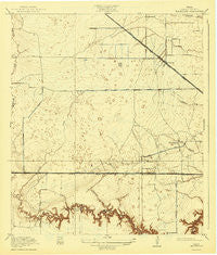
~ Hillendahl TX topo map, 1:31680 scale, 7.5 X 7.5 Minute, Historical, 1918, updated 1943
Hillendahl, Texas, USGS topographic map dated 1918.
Includes geographic coordinates (latitude and longitude). This topographic map is suitable for hiking, camping, and exploring, or framing it as a wall map.
Printed on-demand using high resolution imagery, on heavy weight and acid free paper, or alternatively on a variety of synthetic materials.
Topos available on paper, Waterproof, Poly, or Tyvek. Usually shipping rolled, unless combined with other folded maps in one order.
- Product Number: USGS-5477683
- Free digital map download (high-resolution, GeoPDF): Hillendahl, Texas (file size: 6 MB)
- Map Size: please refer to the dimensions of the GeoPDF map above
- Weight (paper map): ca. 55 grams
- Map Type: POD USGS Topographic Map
- Map Series: HTMC
- Map Verison: Historical
- Cell ID: 19987
- Scan ID: 110762
- Imprint Year: 1943
- Visual Version Number: 0
- Survey Year: 1915
- Datum: NAD
- Map Projection: Polyconic
- Map published by United States Geological Survey
- Map Language: English
- Scanner Resolution: 600 dpi
- Map Cell Name: Hedwig Village
- Grid size: 7.5 X 7.5 Minute
- Date on map: 1918
- Map Scale: 1:31680
- Geographical region: Texas, United States
Neighboring Maps:
All neighboring USGS topo maps are available for sale online at a variety of scales.
Spatial coverage:
Topo map Hillendahl, Texas, covers the geographical area associated the following places:
- Shepherd Trace - Rustling Oaks - Walnut Bend - Thornwood - Nottingham - Spring Valley - Shadow Oaks - Westwick - Gaywood - Dow Acres - Briar Forest - Spring Branch Acres - Spring Branch Gardens - Memorial Grove - Piney Point Village - Frostwood - Lakes on El Ridge - Hilltop Acres - Weschester - Timber Oaks - Concord Bridge - Carver Dale - Lakeside Forest - Memorial Pines - Spring Meadows - Memorial Bend - Nottingham Forest - Ashford Forest - Hennessey - Buckner Haven - Westways - Woods of Lakeside - Royal Oaks - Nottingham West - Sherwood Oaks - Jersey Acres - Memorial Hollow - Memorial Plaza - Fon Villas - Hedwig Village - Yorkridge Center - Moss Oaks - Lois - Bunker Hill Village - Willchester - Fairbanks - Northwest Crossing - Yorkshire - Gessner Grove - Spring Shadows - Heatherwood
- Map Area ID: AREA29.87529.75-95.625-95.5
- Northwest corner Lat/Long code: USGSNW29.875-95.625
- Northeast corner Lat/Long code: USGSNE29.875-95.5
- Southwest corner Lat/Long code: USGSSW29.75-95.625
- Southeast corner Lat/Long code: USGSSE29.75-95.5
- Northern map edge Latitude: 29.875
- Southern map edge Latitude: 29.75
- Western map edge Longitude: -95.625
- Eastern map edge Longitude: -95.5


